

- 2024年-02月-16日:唐土名胜图会.初集.6卷(88P)
- 2024年-02月-16日:唐土名胜图会.初集.5卷(75P)
- 2024年-02月-16日:唐土名胜图会.初集.4卷(78P)
- 2024年-02月-16日:唐土名胜图会.初集.3卷(87P)
- 2024年-02月-16日:唐土名胜图会.初集.2卷(54P)
- 2024年-02月-16日:唐土名胜图会.初集.1卷(62P)
- 2024年-01月-13日:彩图版《中国国家地理百科全书》6、青海、宁夏、新疆、香港(106P)
- 2024年-01月-13日:彩图版《中国国家地理百科全书》5、四川、贵州、云南、西藏(122P)
- 2024年-01月-13日:彩图版《中国国家地理百科全书》4、湖北、湖南、广东、广西(106P)
- 2024年-01月-13日:彩图版《中国国家地理百科全书》3、浙江、安徽、福建、江西(106P)
- 2024年-01月-13日:彩图版《中国国家地理百科全书》2、内蒙古、辽宁、吉林、黑龙(106P)
- 2024年-01月-13日:彩图版《中国国家地理百科全书》1、总论、北京、天津、河北(105P)
- 2024年-01月-13日:《中国景色·彩图版》作者:单之蔷(385P)
- 2023年-12月-16日:宣大山西三镇图说.三卷.明.杨时宁编.景明万历时期刊本.玄览堂丛书.1941年(303P)
- 2023年-12月-16日:渝城图.约绘于1850-1900年.法国国家图书馆藏(12P)
- 2023年-12月-16日:行宫座落图.扬州名胜图.江南名胜图.四册.清代刊本(110P)
- 2023年-12月-16日:异域图志.一卷.剑桥大学图书馆藏.明刊孤本(206P)
- 2023年-09月-24日:泛槎图.含续泛槎图等.全集.清张宝撰.道光时期羊城尚古斋刊刻(500P)
- 2023年-09月-24日:法军远征在埃及考察研究作品集之埃及自然史板画(253P)
- 2023年-09月-21日:新镌海内奇观·六册(60P)
- 2023年-09月-21日:新镌海内奇观·五册(59P)
- 2023年-09月-21日:新镌海内奇观·四册(63P)
- 2023年-09月-21日:新镌海内奇观·三册(72P)
- 2023年-09月-21日:新镌海内奇观·二册(47P)
- 2023年-09月-21日:新镌海内奇观·一册(66P)
- 2023年-06月-14日:百幕大未解之谜(181P)
- 2023年-06月-14日:雍和宫集(1~20)(68P)
- 2023年-04月-25日:故宫宽幅照片(48P)
- 2023年-04月-14日:世界美术全集:建筑卷(97P)
- 2023年-04月-08日:中国建筑艺术史 (下册)(665P)
- 2023年-04月-08日:中国建筑艺术史 (上册)(584P)
- 2023年-04月-08日:建筑装修与装饰·中国建筑艺术全集 24(242P)
- 2023年-04月-05日:宅第建筑 4 南方少数民族·中国建筑艺术全集 23(330P)
- 2023年-04月-05日:宅第建筑 3 北方少数民族·中国建筑艺术全集 22(219P)
- 2023年-03月-27日:游遍世界(172P)
- 2023年-03月-27日:宅第建筑 2 南方汉族·中国建筑艺术全集 21(333P)
- 2023年-03月-27日:佛教建筑(2)(南方) (丁承樸)·中国建筑艺术全集(319P)
- 2023年-03月-23日:游遍中国(172P)
- 2023年-03月-16日:宅第建筑1 北方汉族·中国建筑艺术全集 20(325P)
- 2023年-03月-16日:风景建筑·中国建筑艺术全集 19(320P)
- 2023年-03月-10日:私家园林·中国建筑艺术全集 18(328P)
- 2023年-03月-10日:皇家园林·中国建筑艺术全集 17(249P)
- 2023年-03月-05日:道教建筑·中国建筑艺术全集 15(318P)
- 2023年-03月-05日:会馆建筑·祠堂建筑·中国建筑艺术全集 11(299P)
- 2023年-03月-02日:书院建筑·中国建筑艺术全集 10(320P)
- 2023年-03月-02日:坛庙建筑·中国建筑艺术全集 9(333P)
- 2023年-02月-28日:泰晤士世界历史地图集(360P)
- 2023年-02月-27日:清代陵墓建筑·中国建筑艺术全集 8(280P)
- 2023年-02月-27日:明代陵墓建筑·中国建筑艺术全集 7(328P)
- 2023年-02月-25日:元代前陵墓建筑·中国建筑艺术全集 6(313P)
- 2023年-02月-25日:桥梁、水利建筑·中国建筑艺术全集 5(334P)
- 2023年-02月-24日:古代城镇·中国建筑艺术全集 4(317P)
- 2023年-02月-24日:宫殿建筑(3) 沈阳·中国建筑艺术全集(312P)
- 2023年-02月-24日:宫殿建筑(2)(北京)·中国建筑艺术全集(311P)
- 2023年-02月-24日:宫殿建筑(1)(北京)·中国建筑艺术全集(247P)
- 2023年-02月-09日:镇江胜境图暨乾隆御题诗刻.清高宗弘历撰并书.民国拓本(6P)
- 2023年-02月-07日:西湖佳景.湖上扶摇子辑.彩色图绘套印本.1750(22P)
- 2023年-02月-04日:亚细亚大观.照片.亚细亚写-真大观社编.1935-1942(396P)
- 2023年-01月-29日:韩国舆地图.金鸿圭模绘.1893(13P)
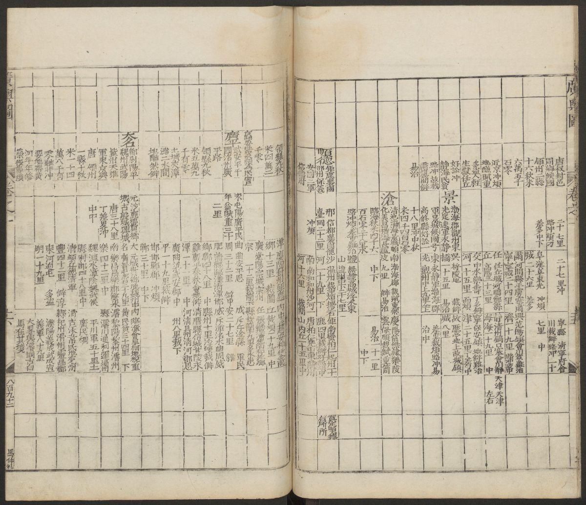
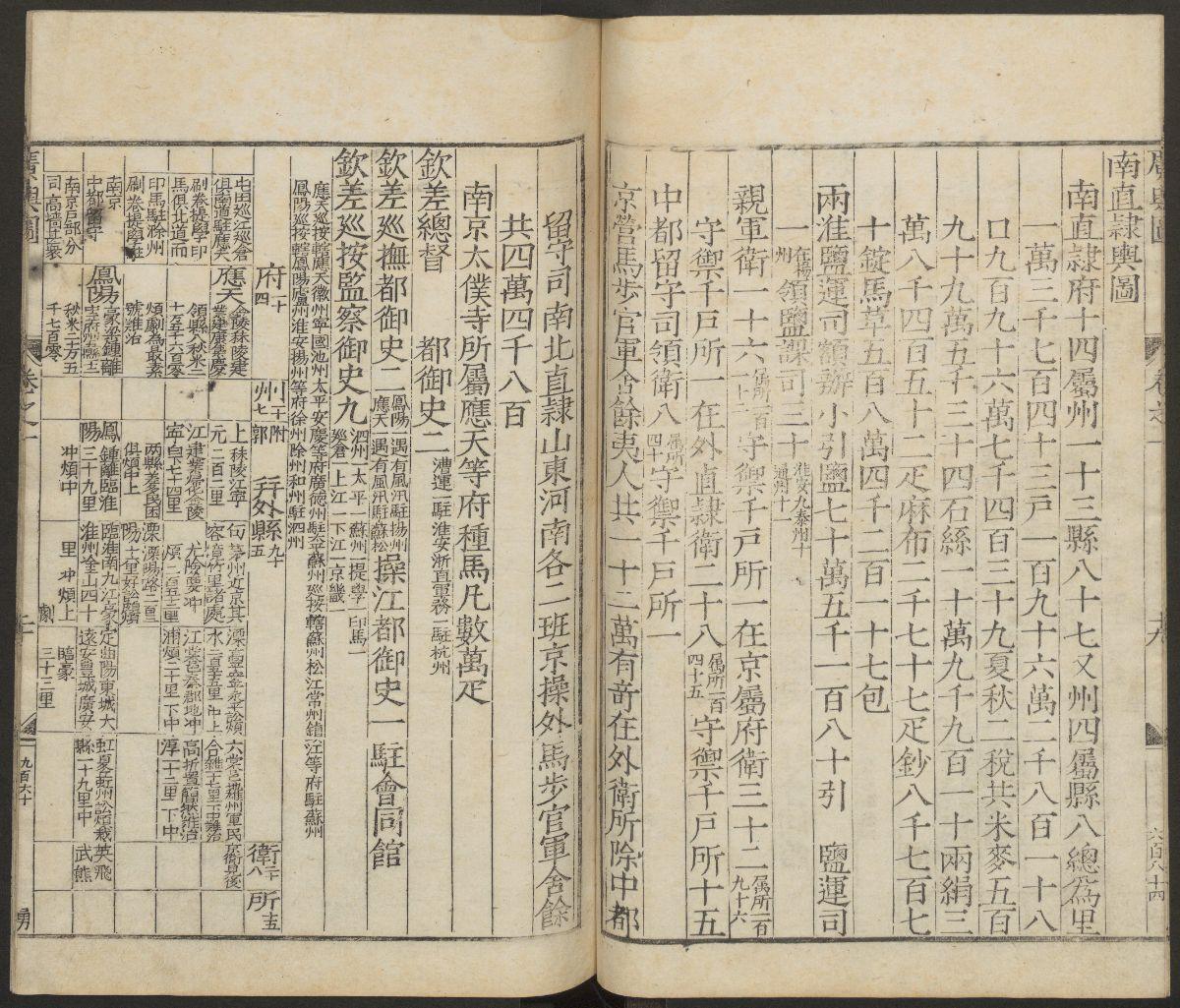
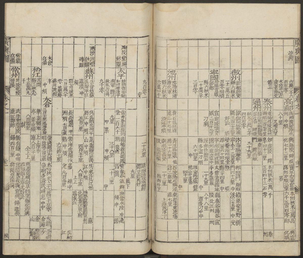
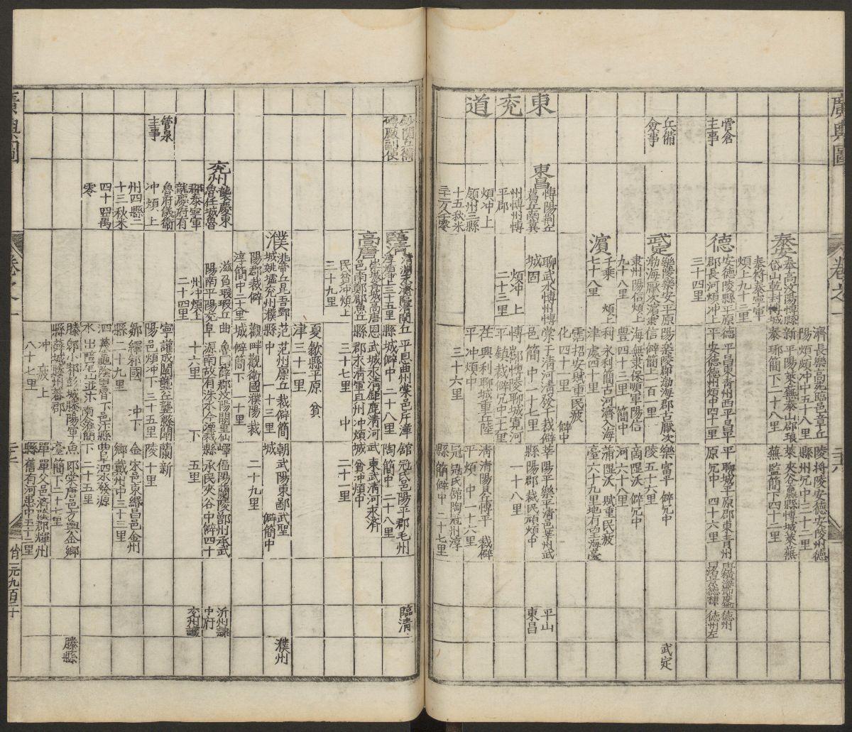
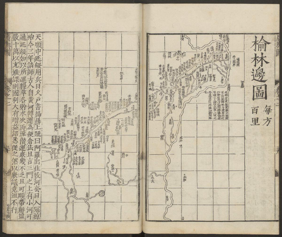
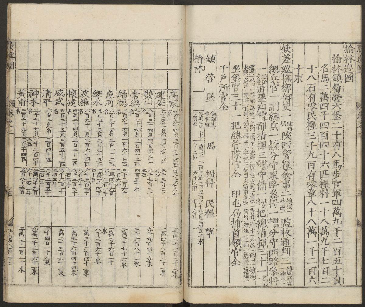
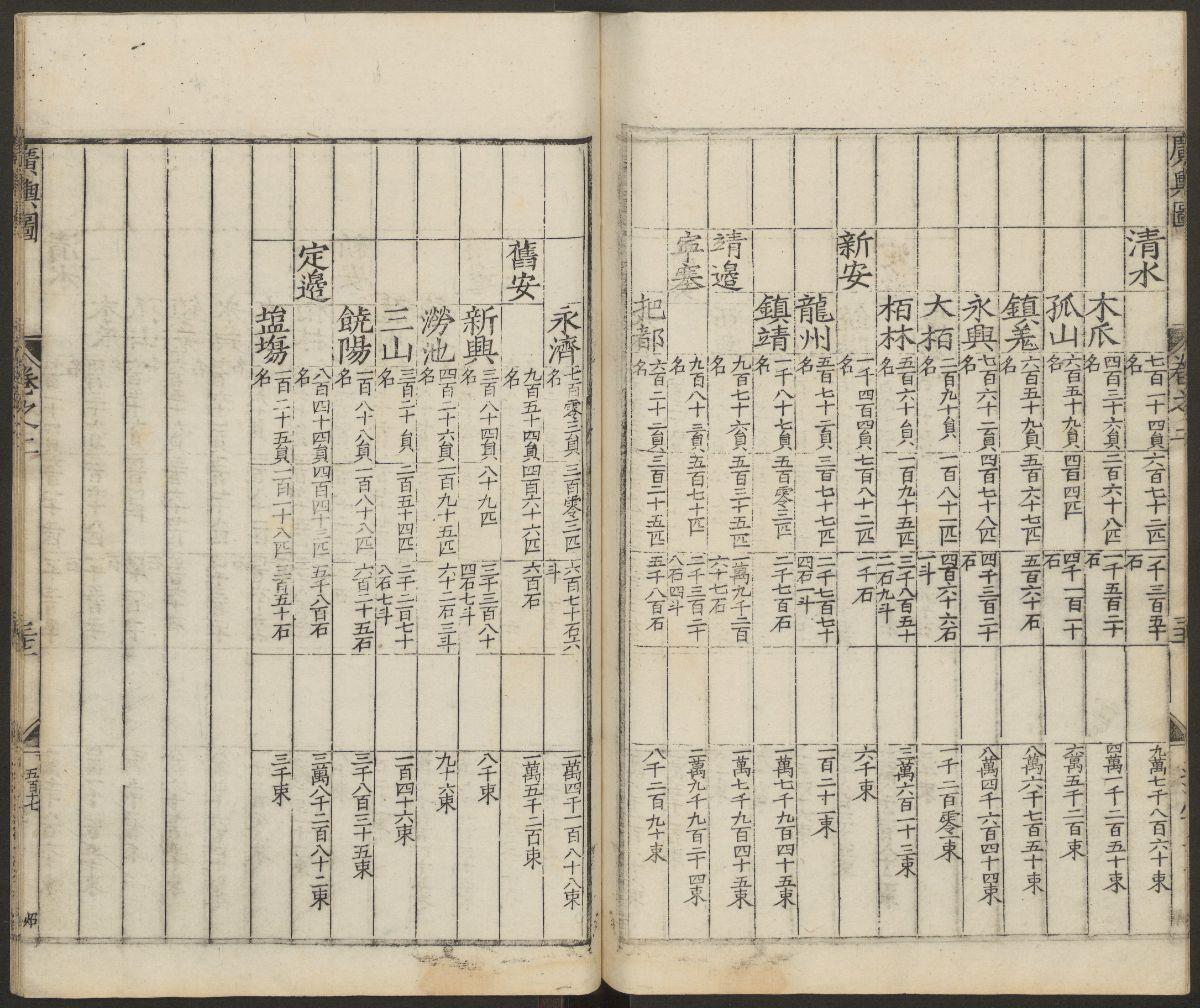
- 2023年-01月-29日:《廣輿圖》二卷【明】朱思(237P)
- 2023年-01月-27日:古今历代中华地图(16P)
- 2023年-01月-17日:江戸絵図.鍬形紹真画(6P)
- 2023年-01月-13日:中國博物館藏畫.上海博物館藏畫(128P)
- 2023年-01月-12日:万国博覧会日本館仮図案(25P)
- 2023年-01月-03日:江苏至北京运河全图(13P)
- 2022年-12月-31日:東京真画名所図解.井上探景画(22P)
- 2022年-12月-29日:岸圃大观.乾坤.明彭汝楠辑.崇祯11刊(37P)
- 2022年-12月-24日:Matrícula de tributos.墨西哥.贡品录(32P)
- 2022年-12月-24日:北京皇城图(3P)
- 2022年-12月-17日:海底世界 珊瑚礁和鱼类的天堂(368P)
- 2022年-12月-15日:第八册(清时期)中国历史地图集(142P)
- 2022年-12月-15日:第七册(元 明)中国历史地图集(193P)
- 2022年-12月-15日:第六册(宋辽金)中国历史地图集(131P)
- 2022年-12月-15日:第五册(隋唐五代)中国历史地图集(150P)
- 2022年-12月-14日:第四册(南北朝)中国历史地图集(108P)
- 2022年-12月-14日:第三册(魏晋)中国历史地图集(91P)
- 2022年-12月-14日:第二册(秦汉)中国历史地图集(101P)
- 2022年-12月-14日:第一册(先秦)中国历史地图集(92P)
- 2022年-12月-10日:中国地方志辞典之二(405P)
- 2022年-12月-10日:中国地方志辞典之一(400P)
- 2022年-12月-04日:[典藏国家地理:中国版(下)].龚勋.全彩版(113P)
- 2022年-12月-04日:[典藏国家地理:中国版(中)].龚勋.全彩版(113P)
- 2022年-12月-04日:[典藏国家地理:中国版(上)].龚勋.全彩版(113P)
- 2022年-11月-23日:地理龙穴扼要 第10册(133P)
- 2022年-11月-23日:地理龙穴扼要 第9册(147P)
- 2022年-11月-23日:地理龙穴扼要 第8册(109P)
- 2022年-11月-23日:地理龙穴扼要 第7册(119P)
- 2022年-11月-22日:地理龙穴扼要 第6册(101P)
- 2022年-11月-22日:地理龙穴扼要 第5册(97P)
- 2022年-11月-21日:地理龙穴扼要 第4册(157P)
- 2022年-11月-21日:地理龙穴扼要 第3册(87P)
- 2022年-11月-20日:地理龙穴扼要 第2册(156P)
- 2022年-11月-20日:地理龙穴扼要 第1册(128P)
- 2022年-11月-07日:世界经济地理(245P)
- 2022年-11月-03日:环球国家地理百科全书之七(214P)
- 2022年-11月-03日:环球国家地理百科全书之六(400P)
- 2022年-11月-03日:环球国家地理百科全书之五(400P)
- 2022年-11月-03日:环球国家地理百科全书之四(400P)
- 2022年-11月-03日:环球国家地理百科全书之三(400P)
- 2022年-11月-03日:环球国家地理百科全书之二(400P)
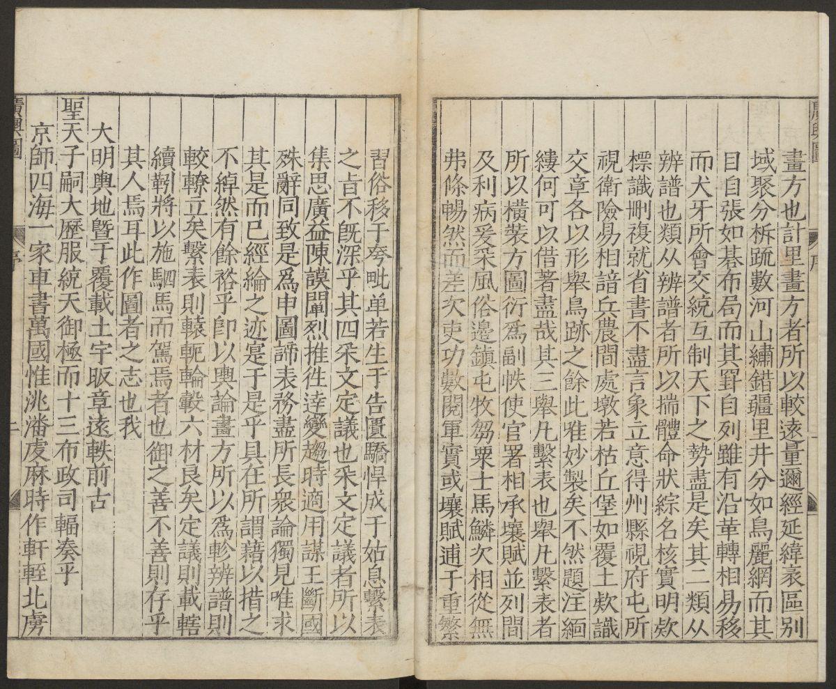
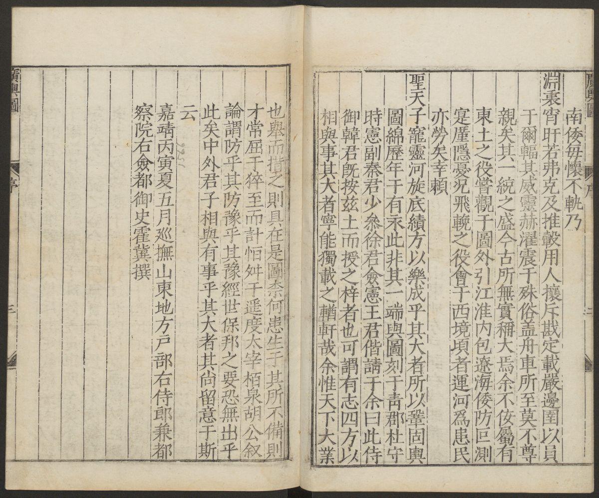
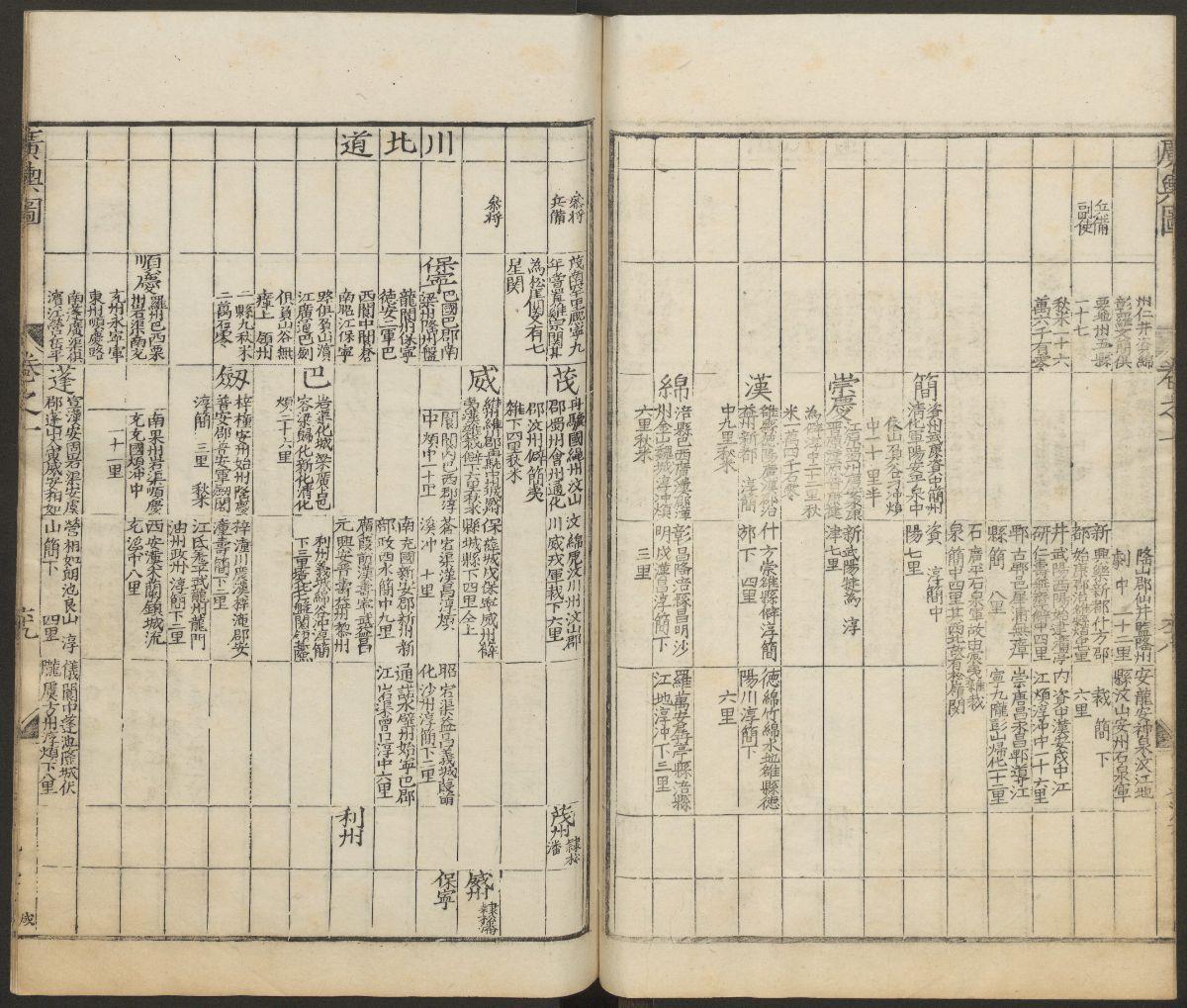
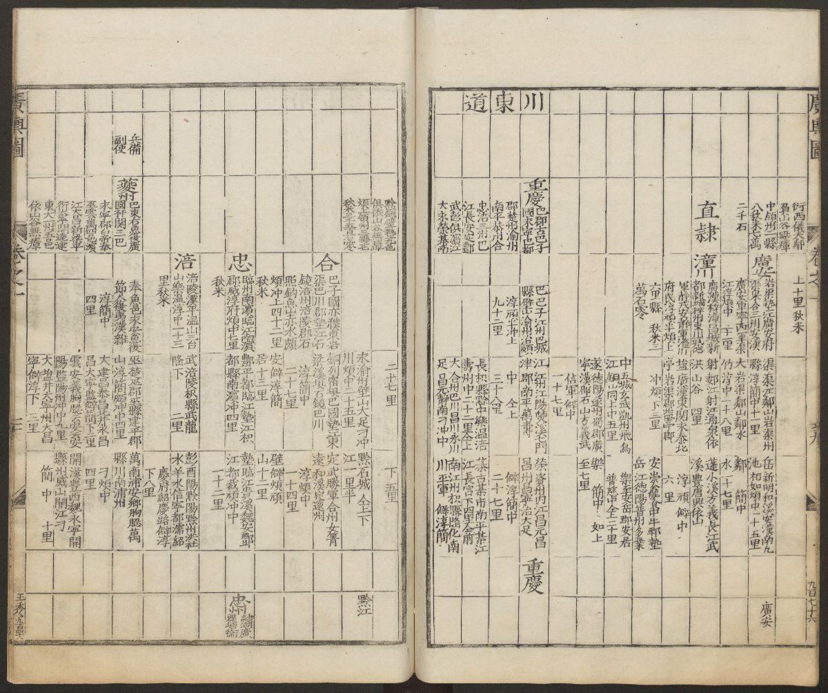
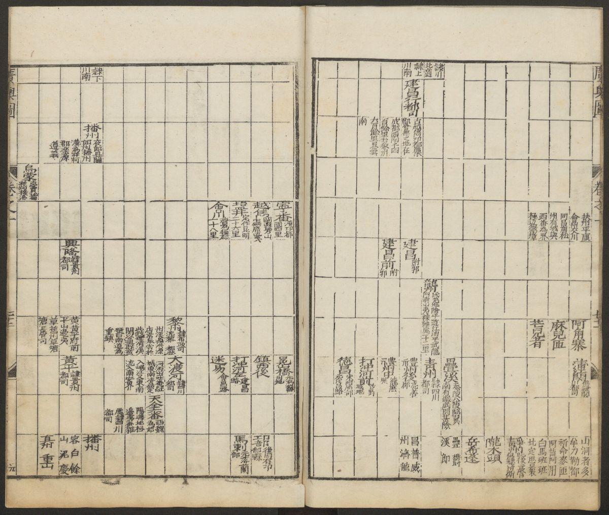
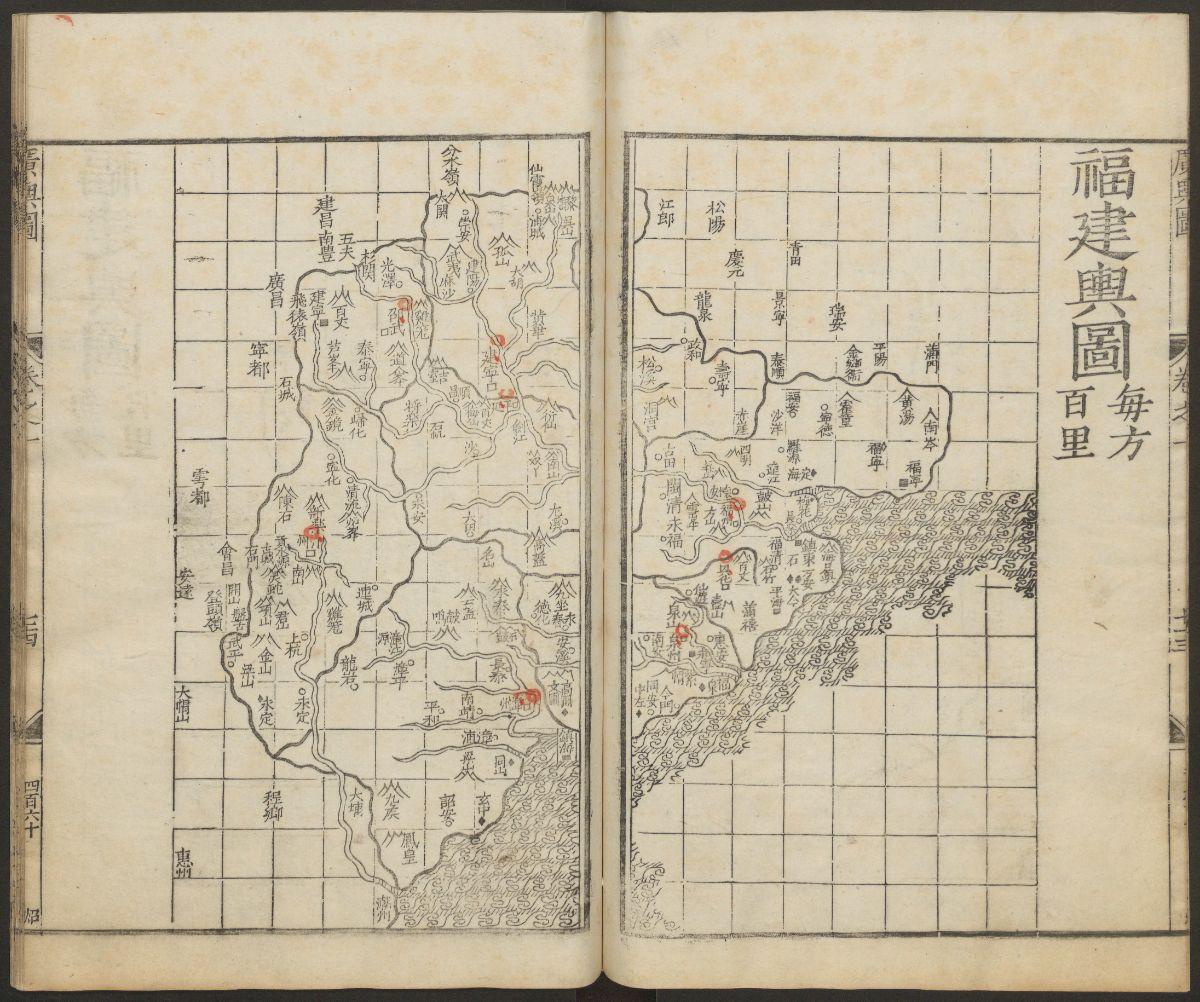
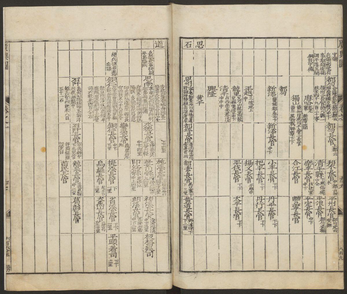
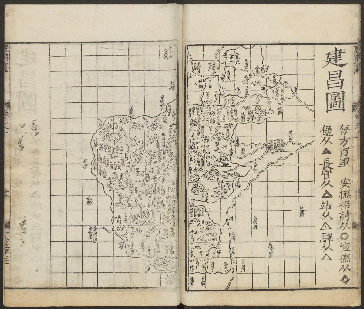
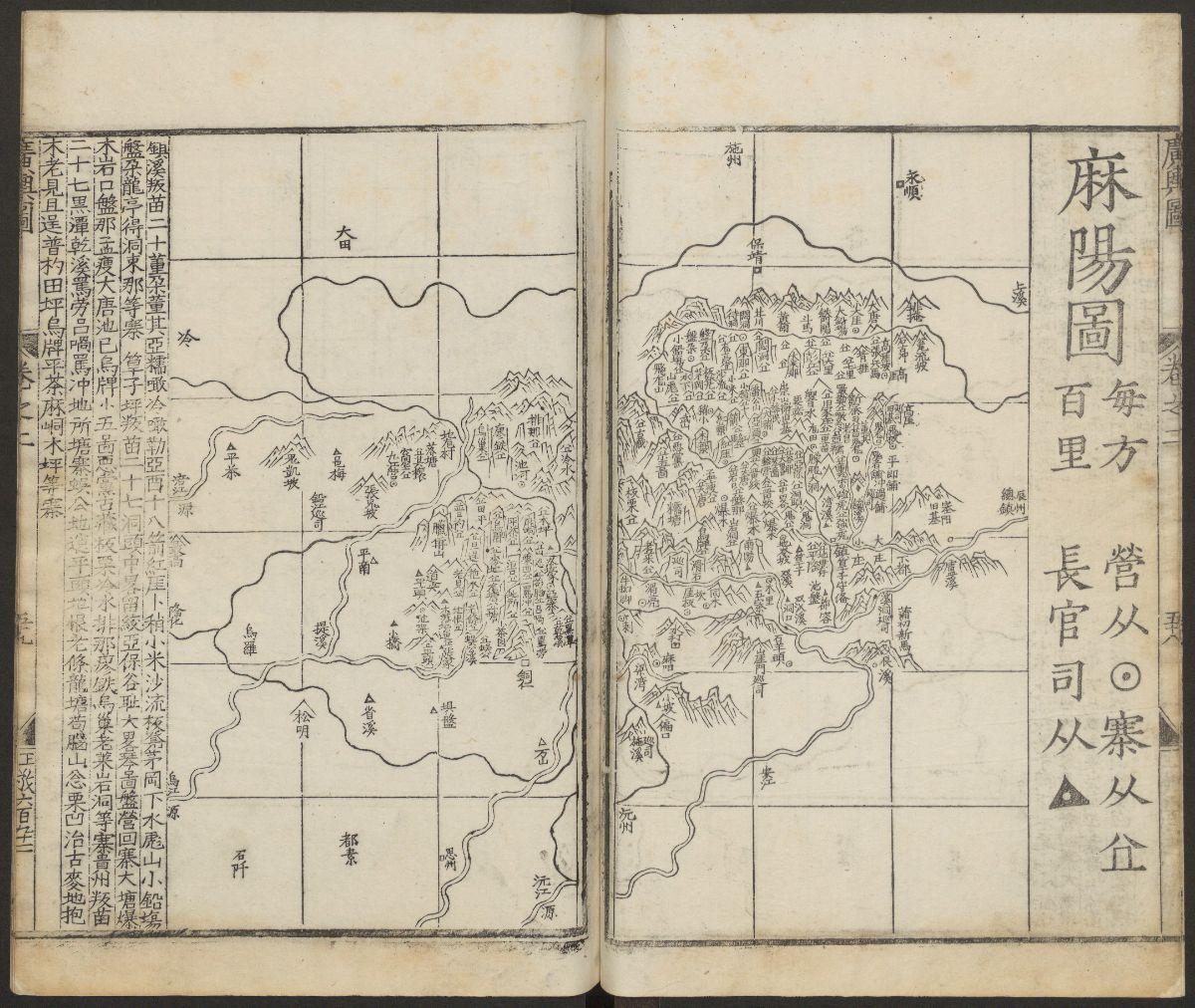
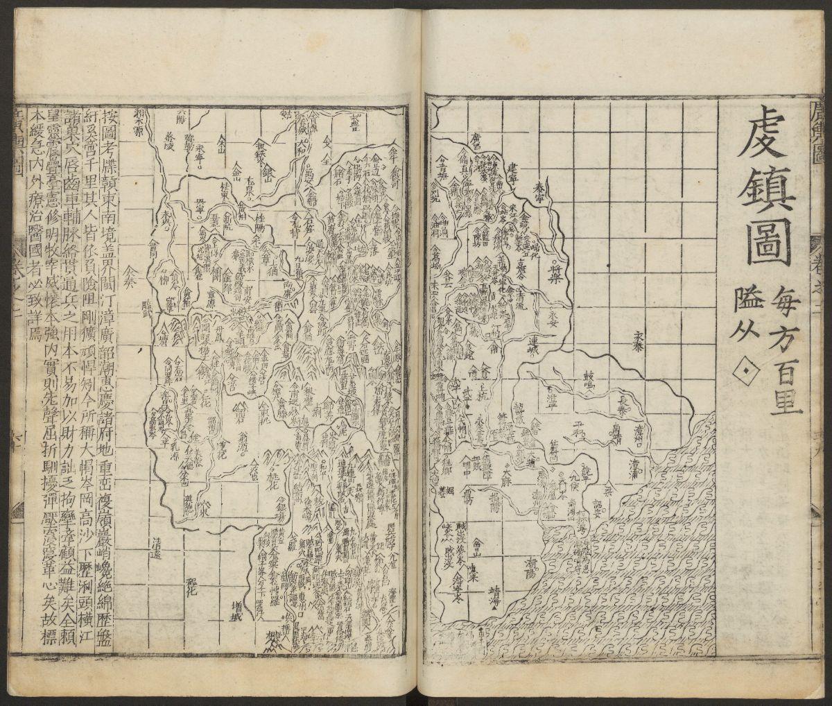
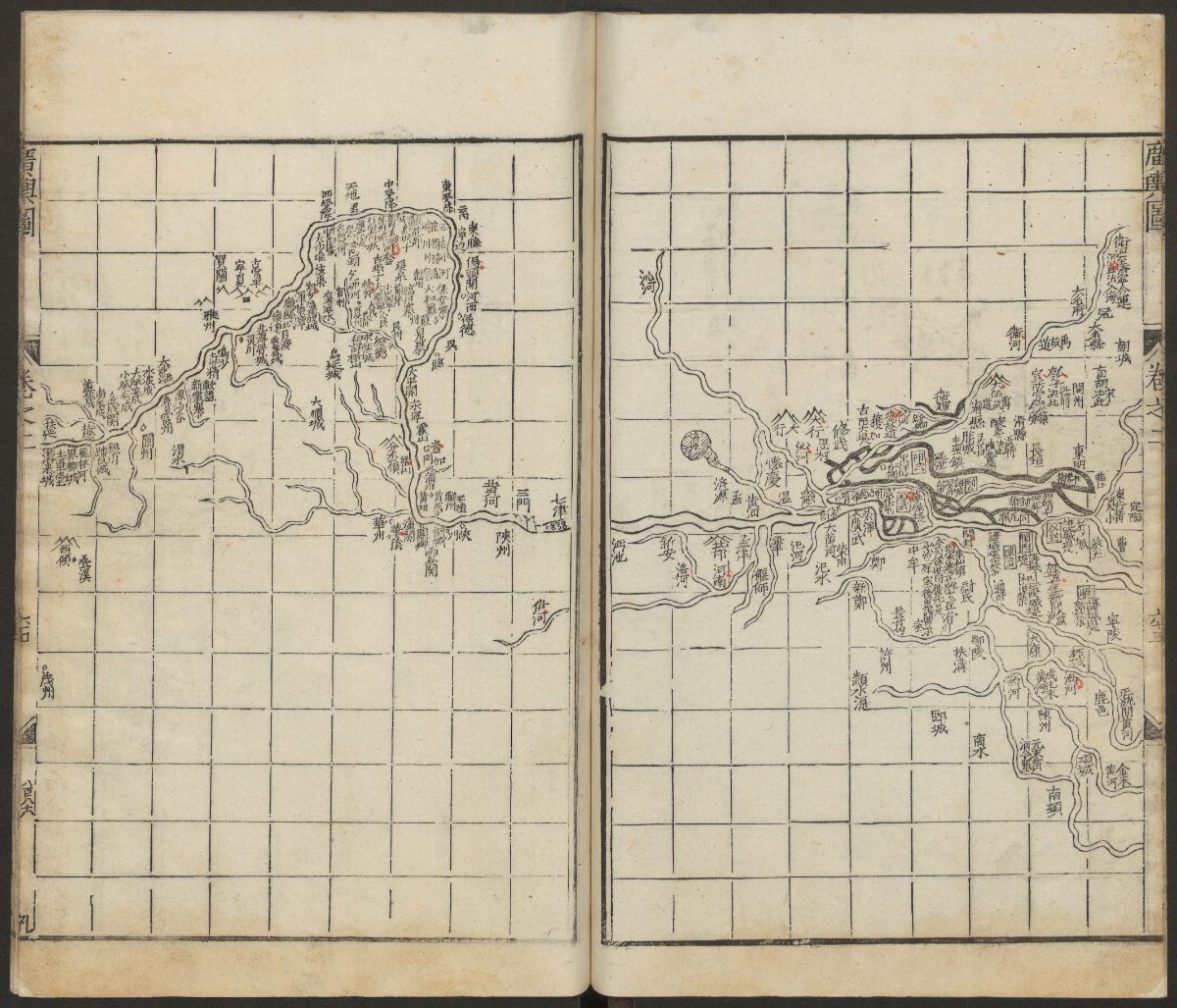
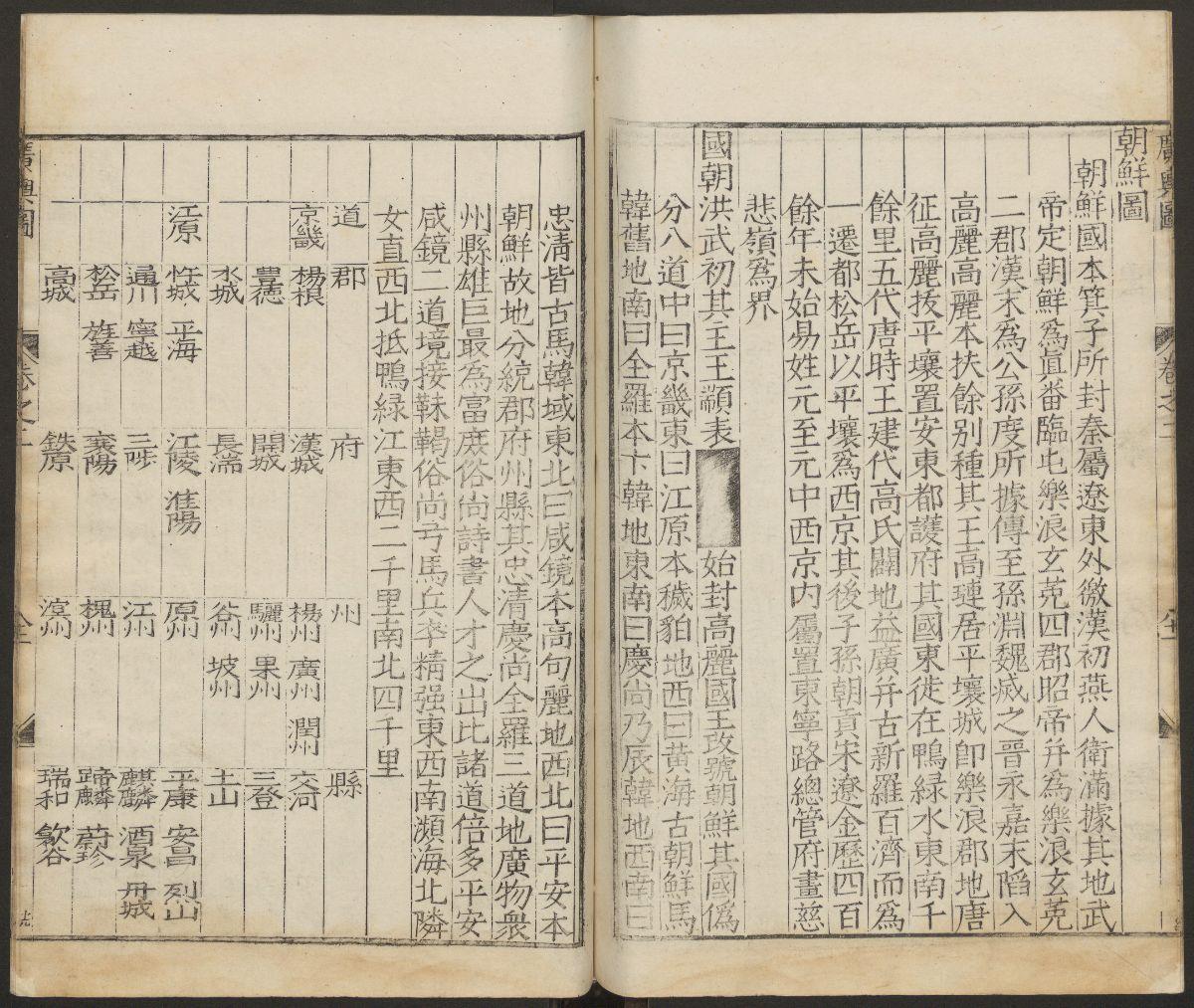
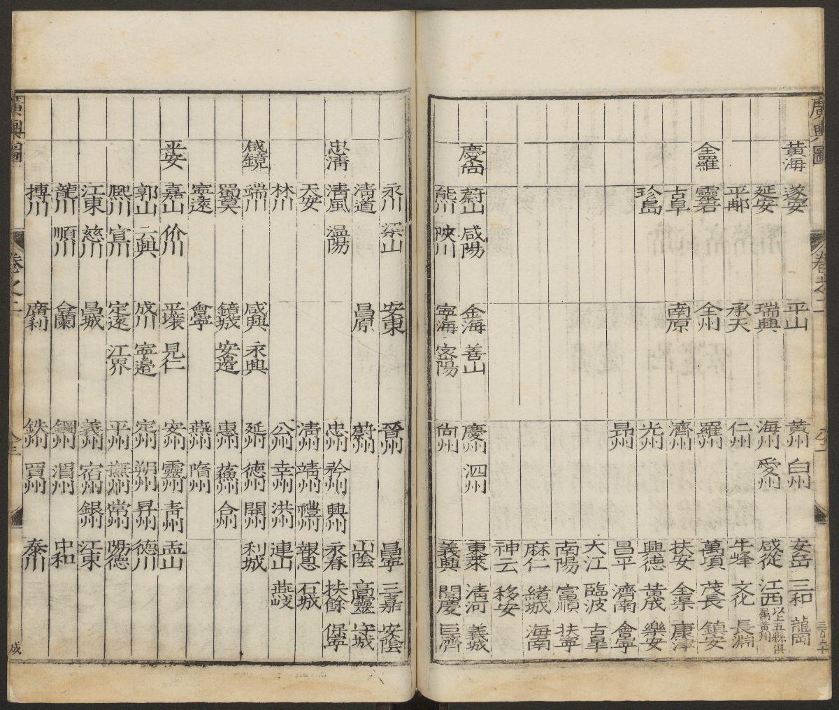
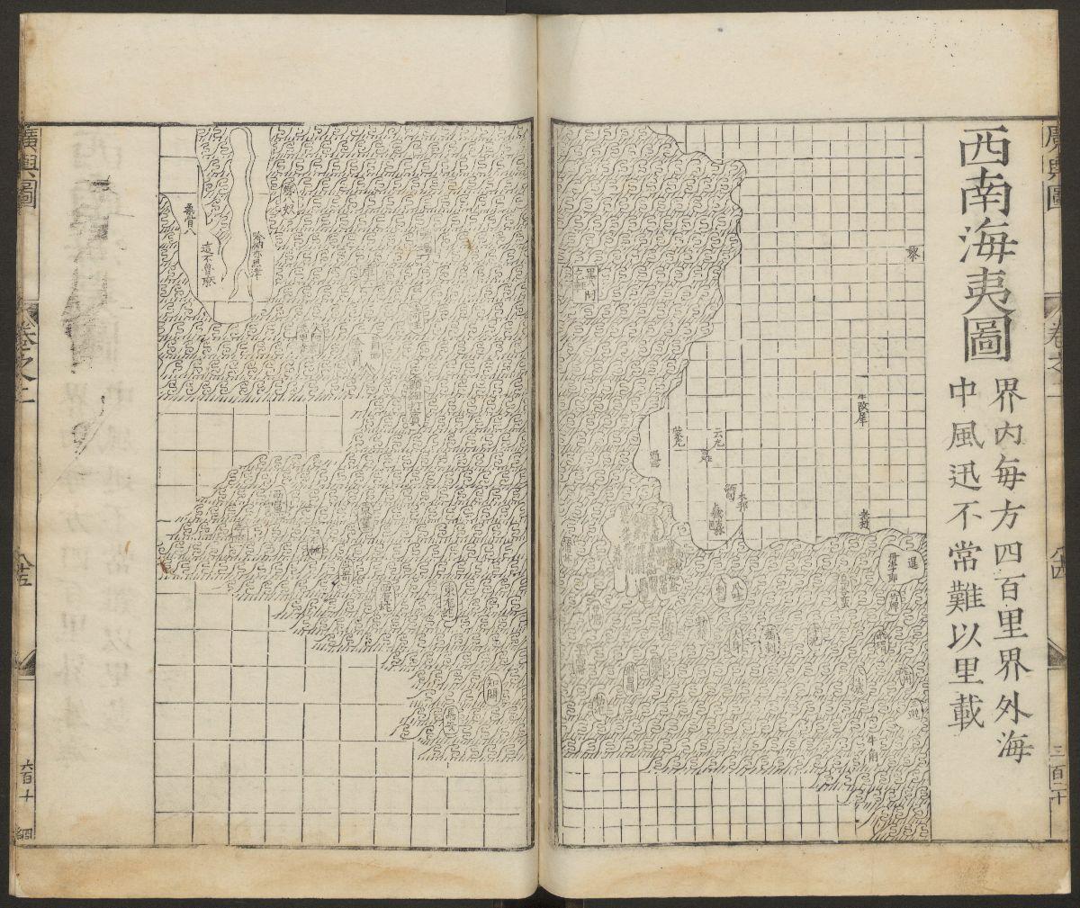
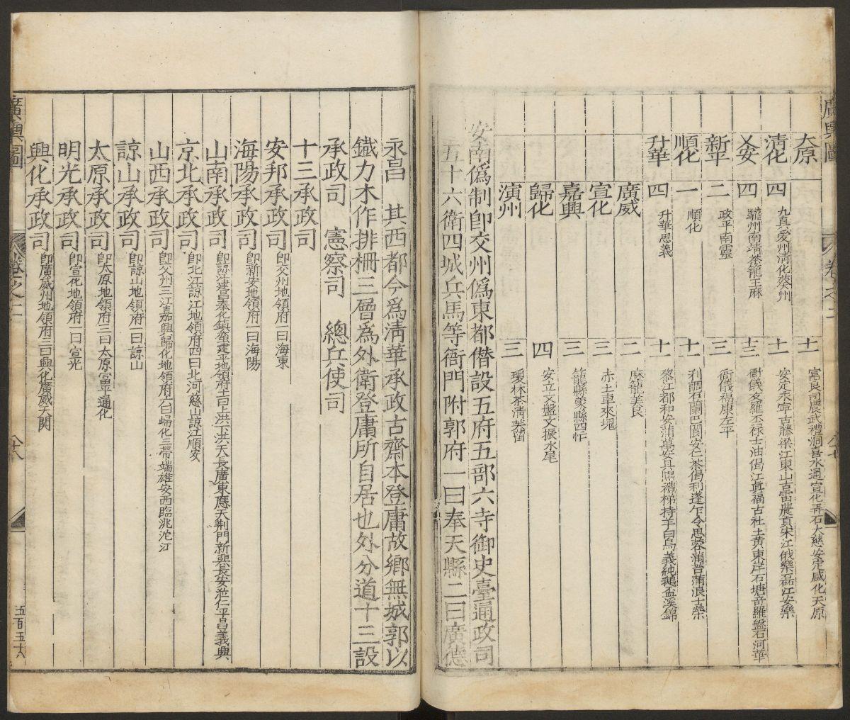
《廣輿圖》二卷【明】朱思本(1273-1335)朱思本撰 羅洪先補訂 出版商:韓君恩 杜思 明嘉靖45年(西元1556年)
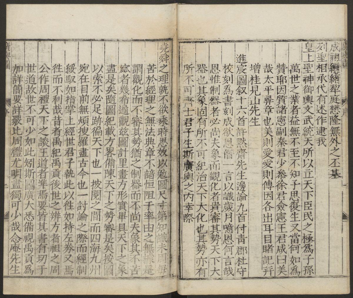
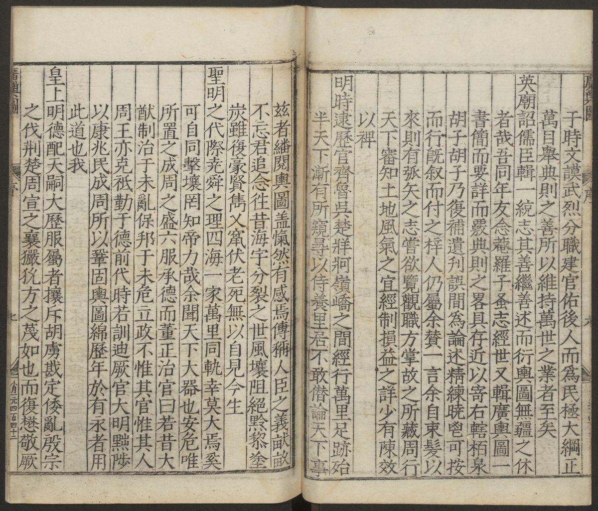
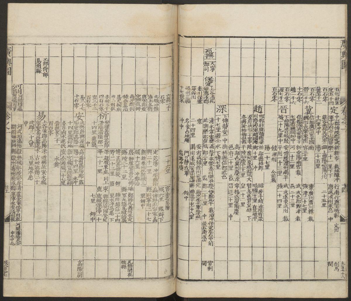
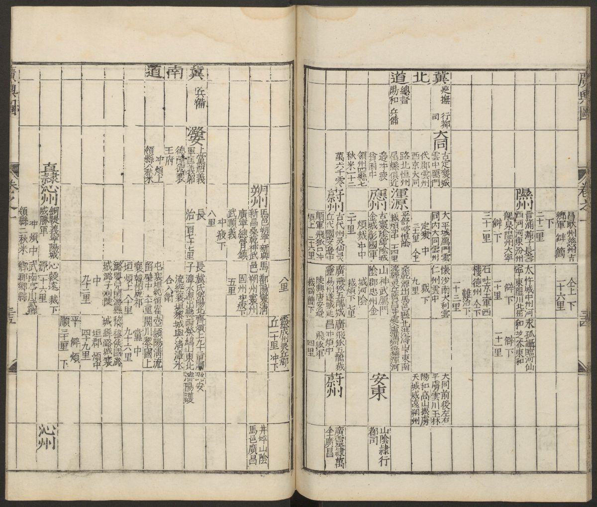
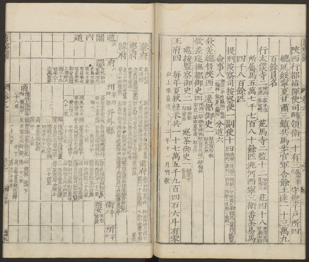
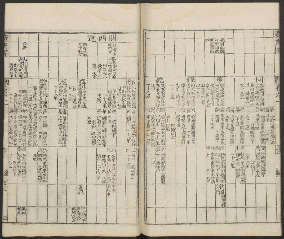
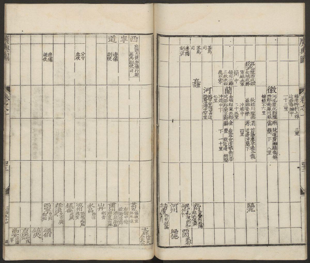
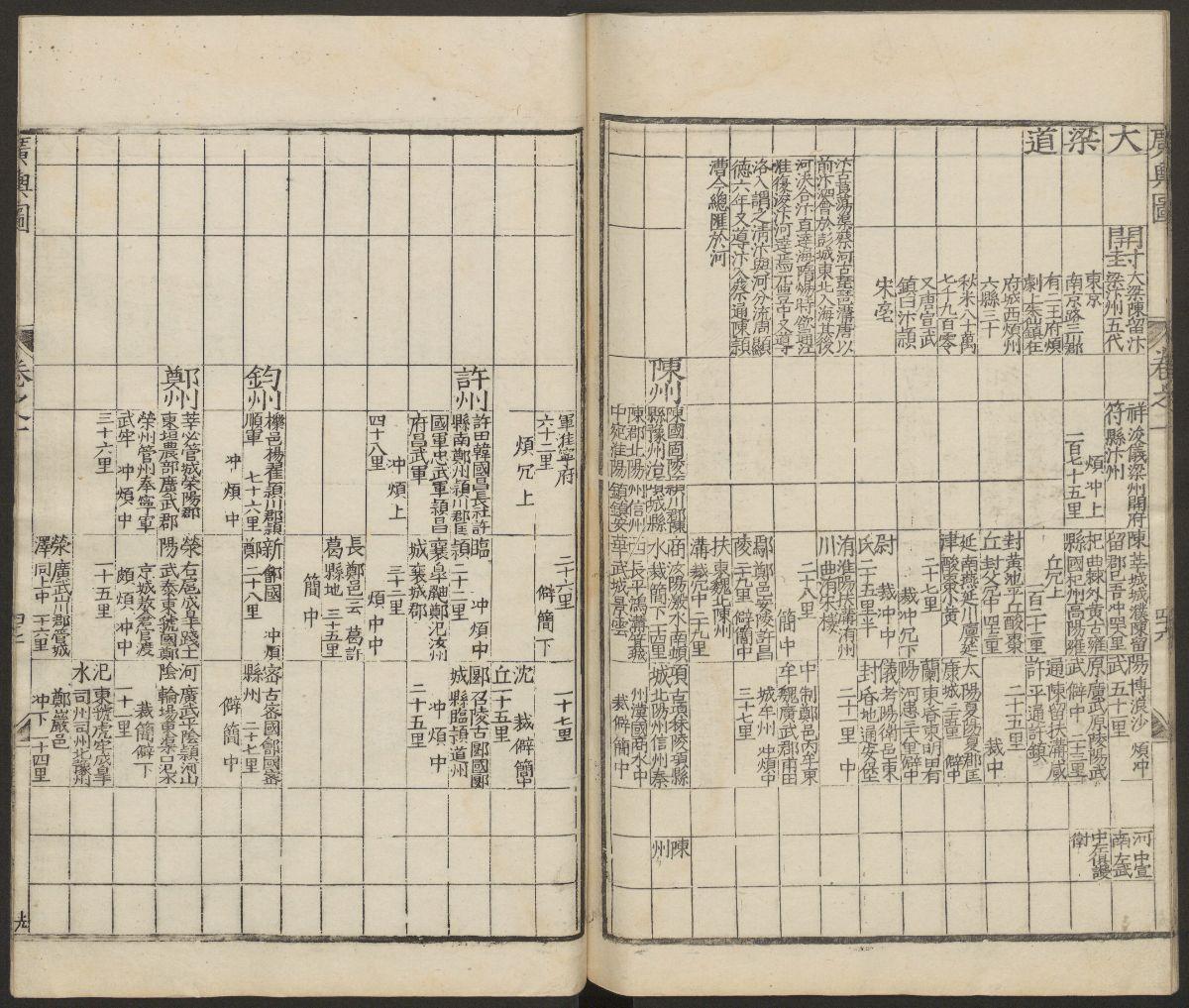
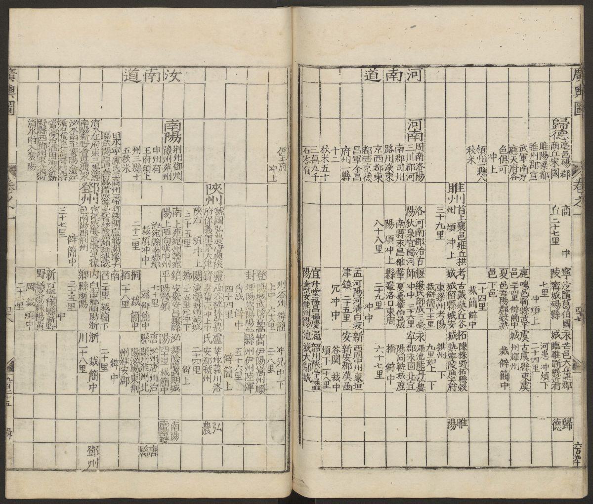
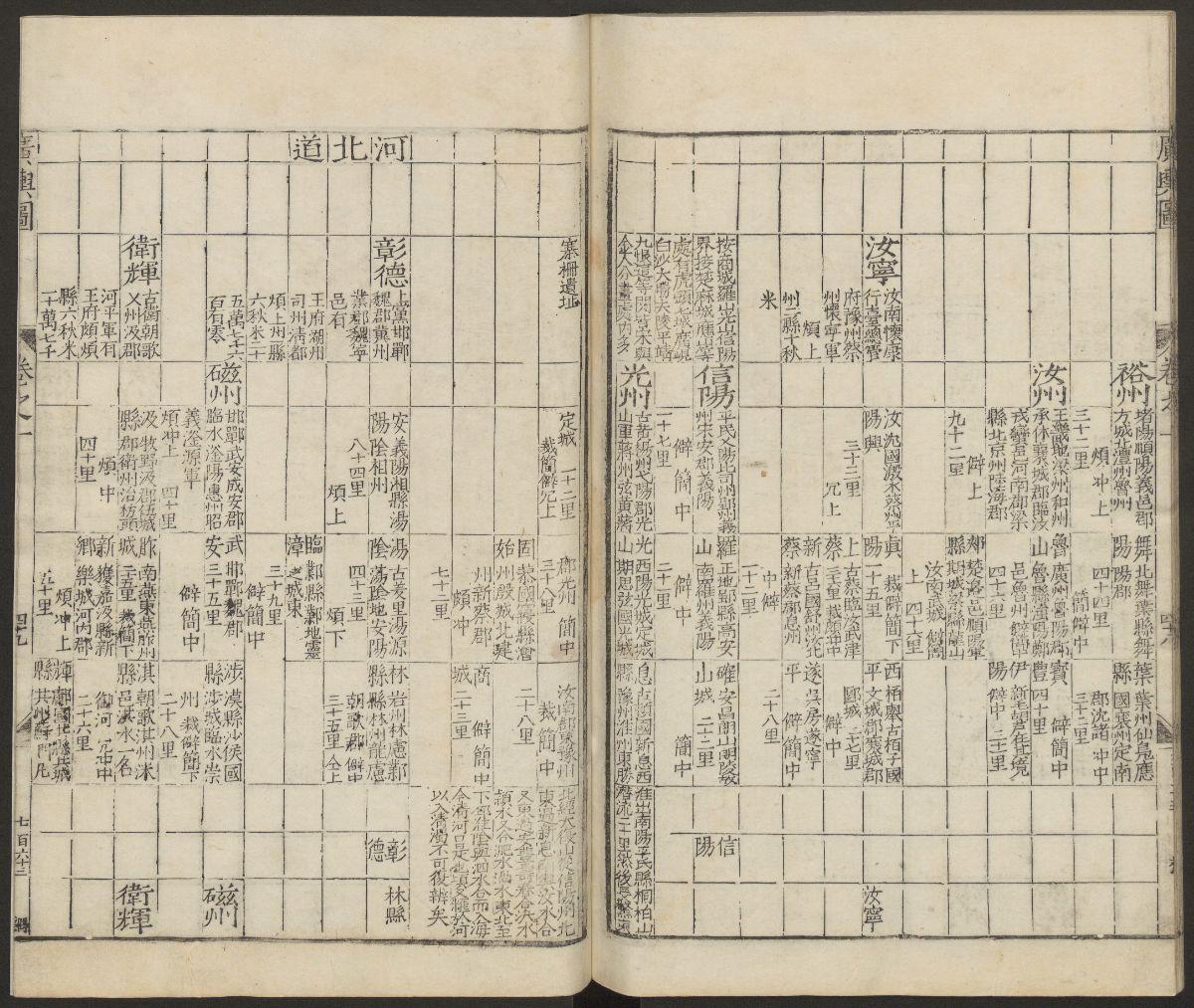
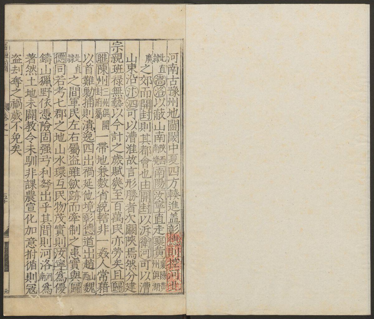
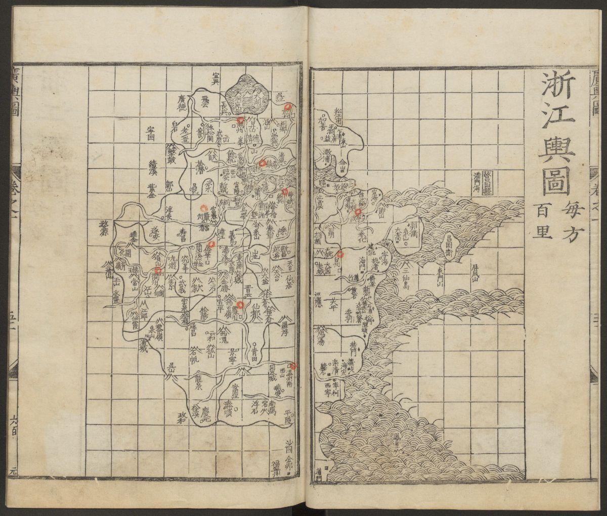
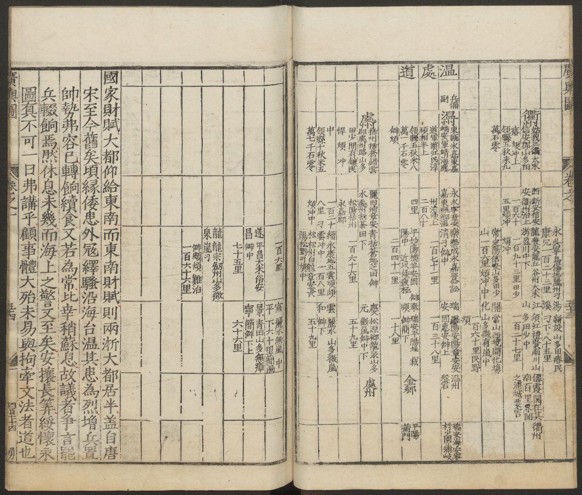
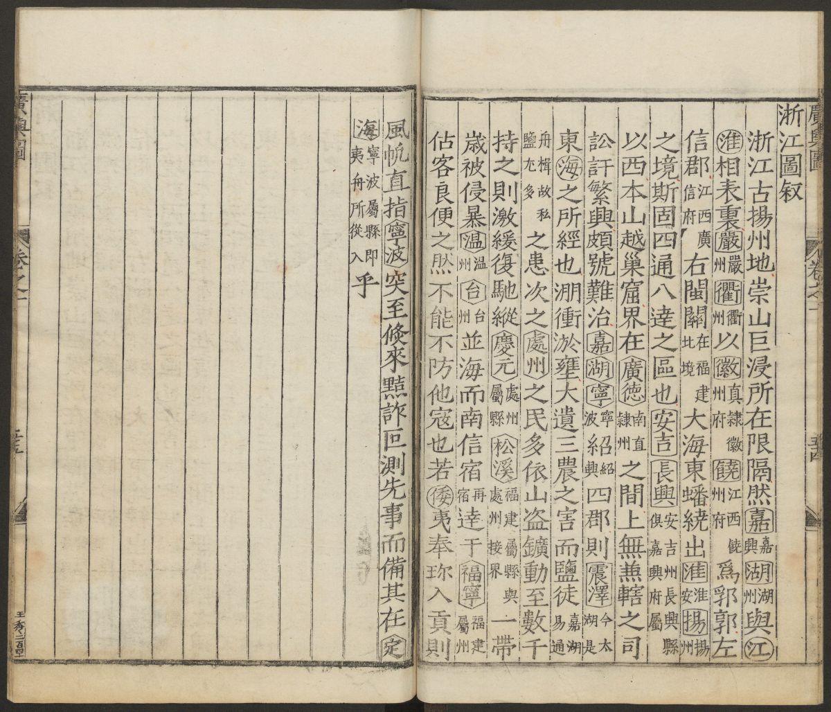
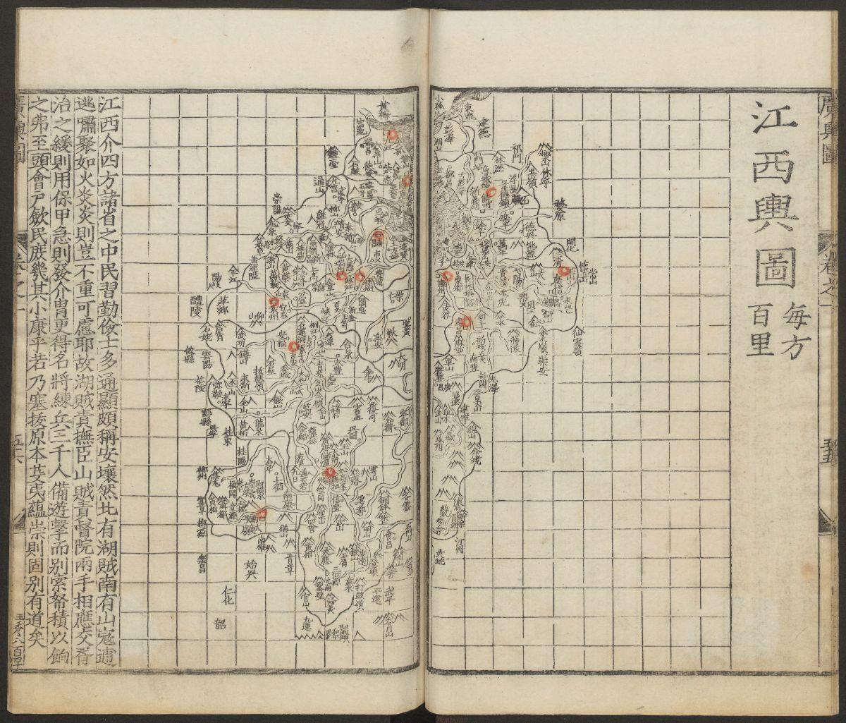
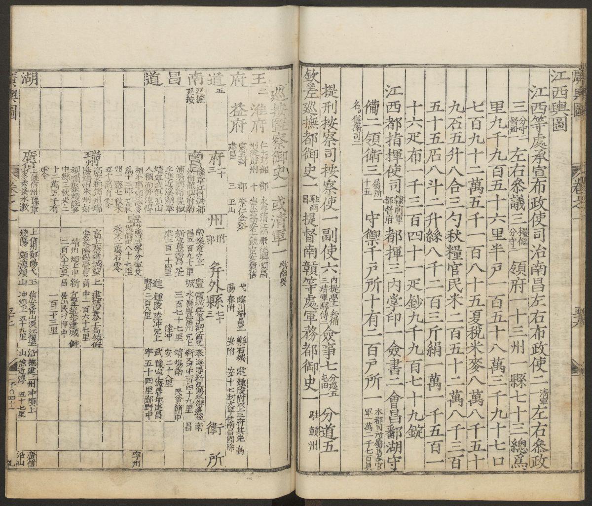
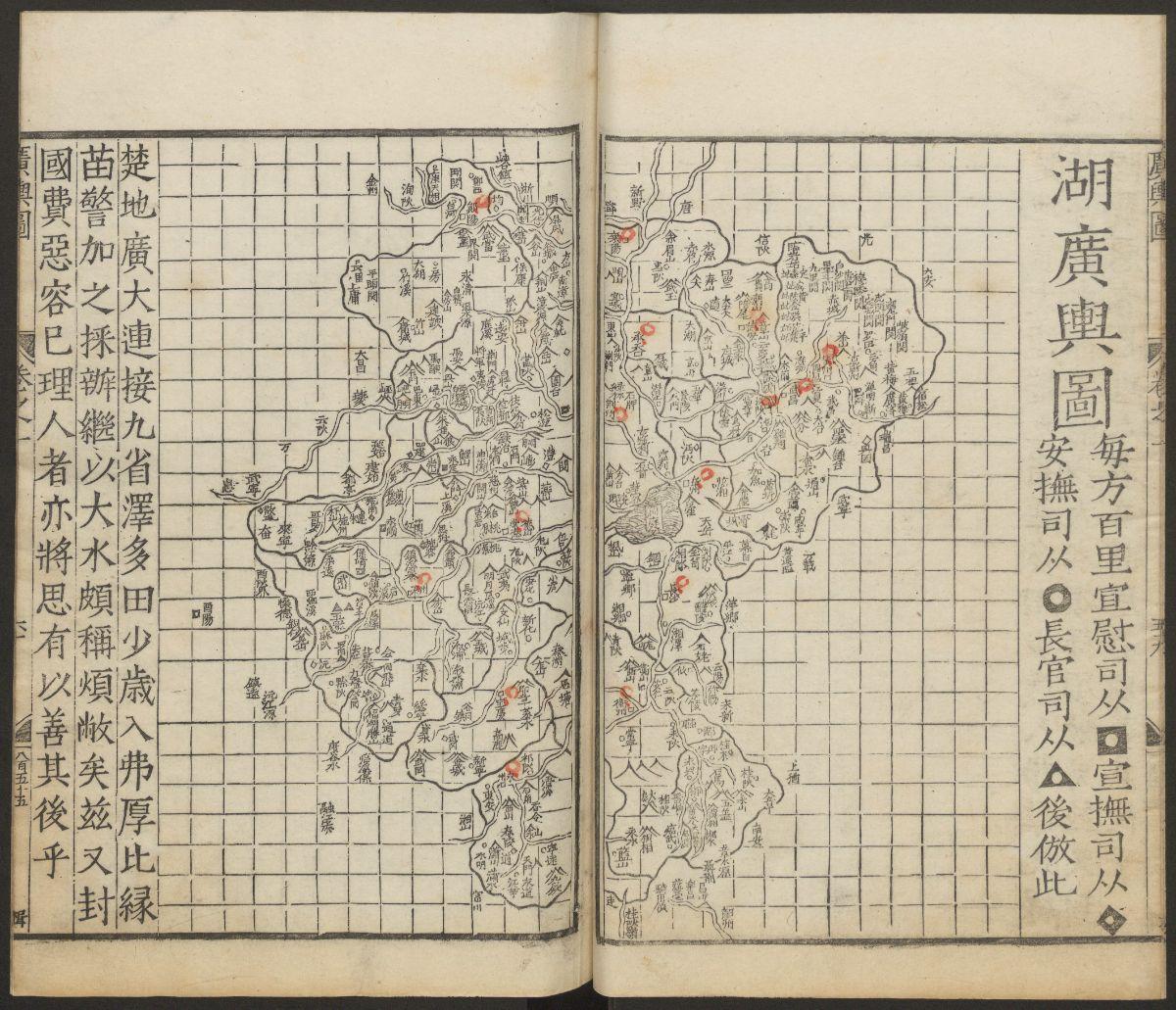
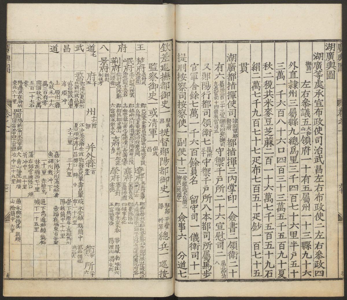
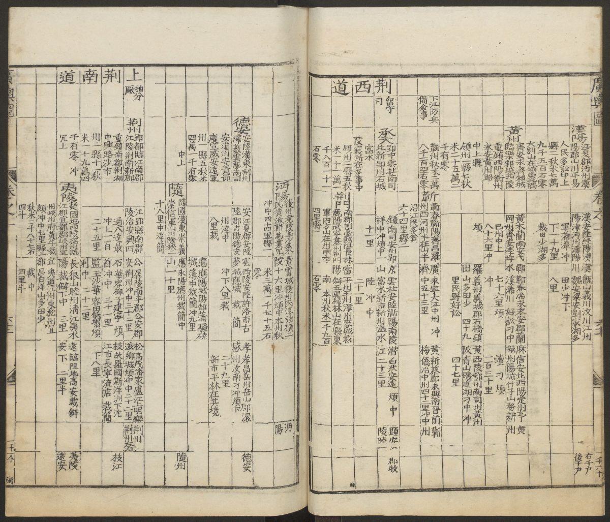
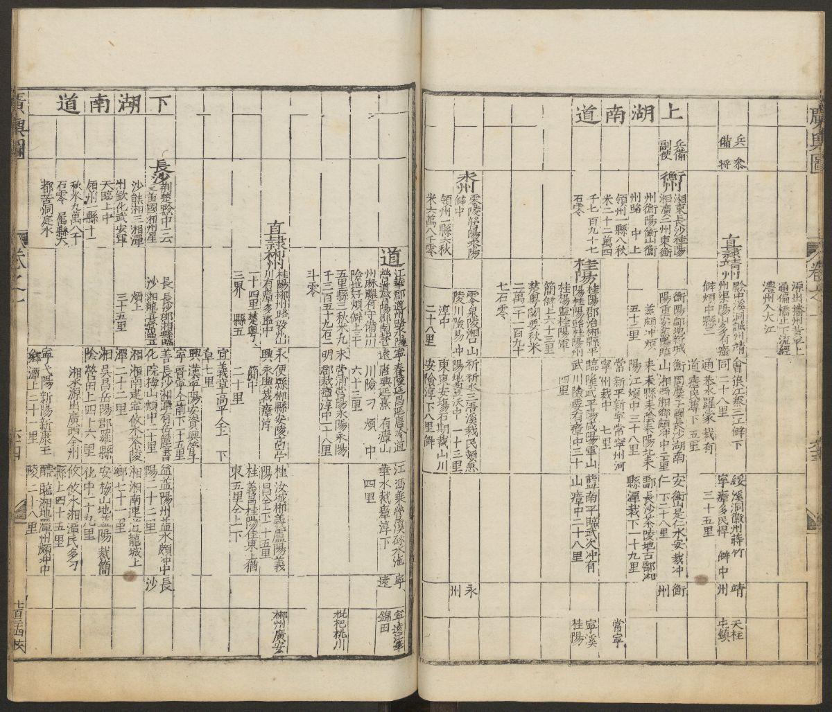
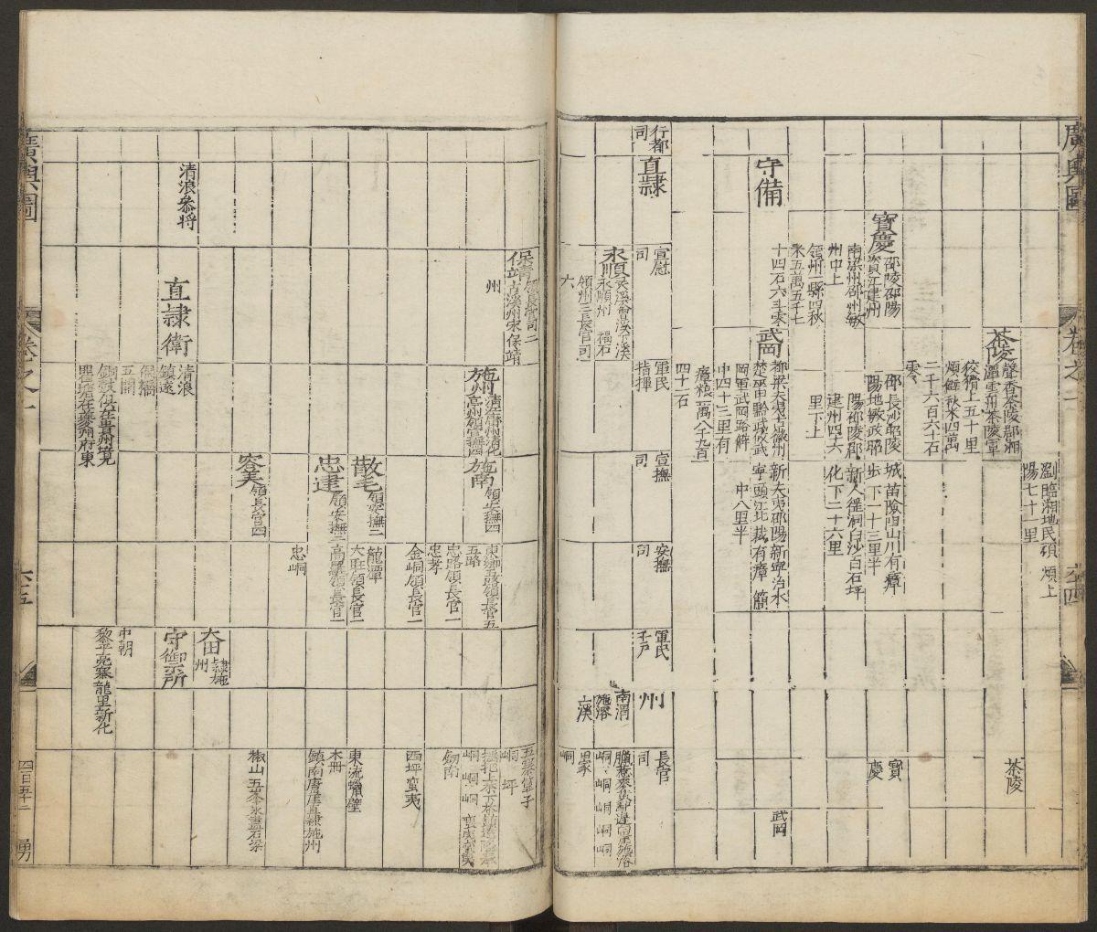
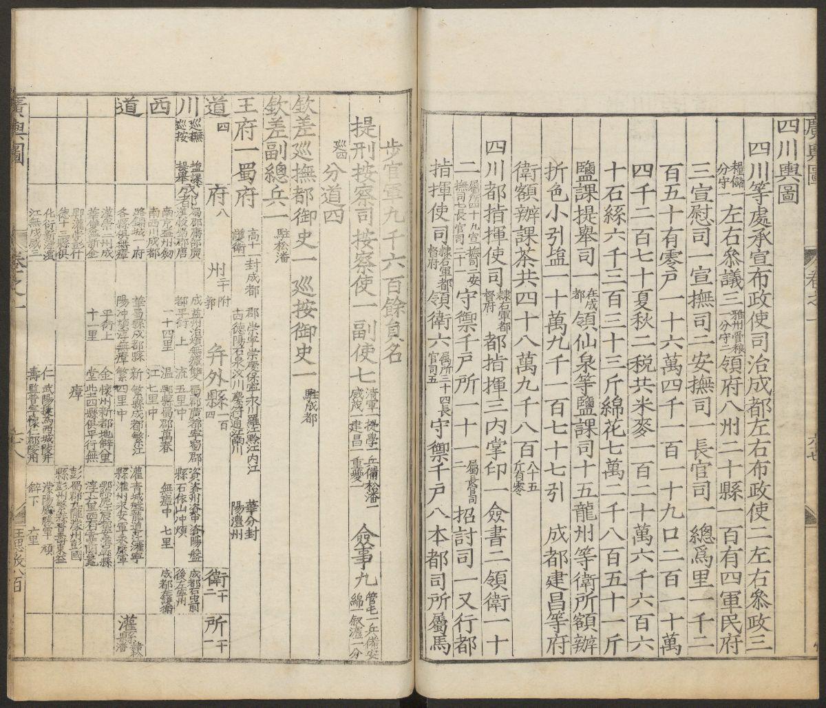
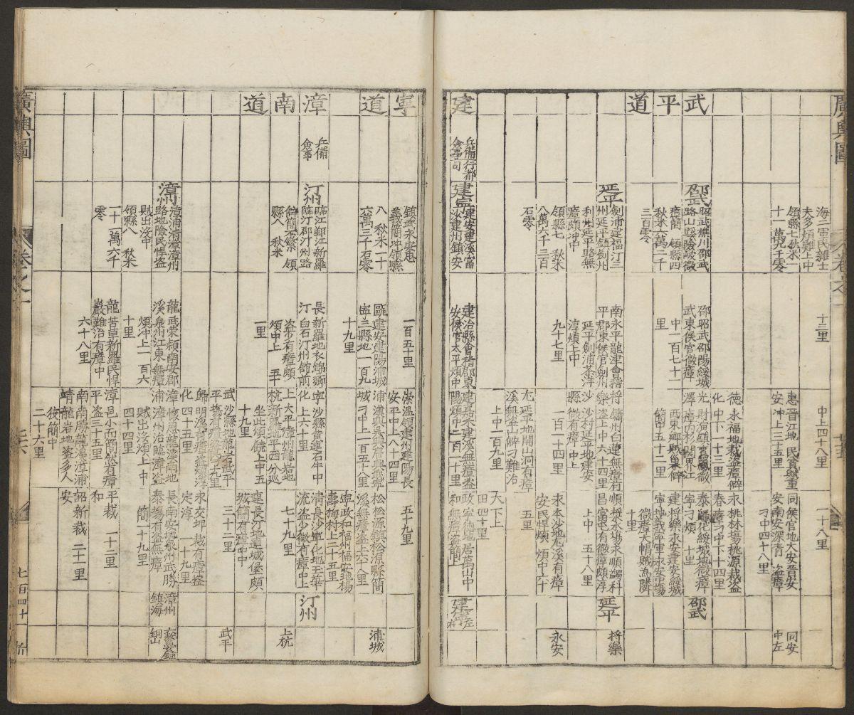
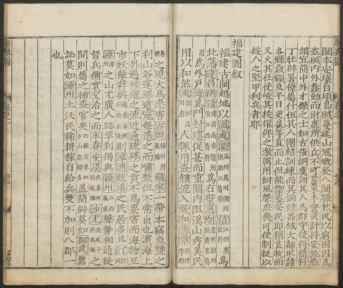
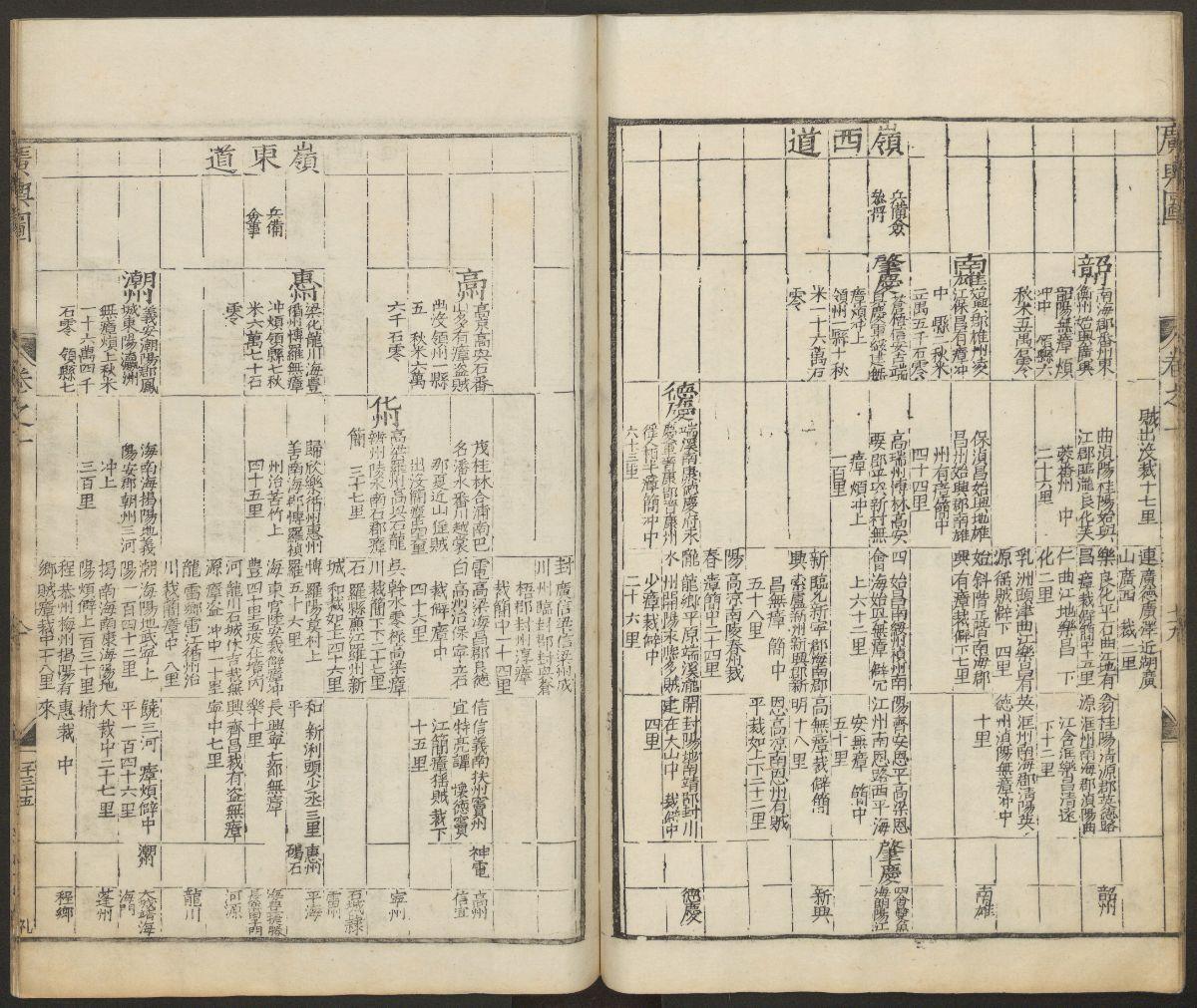
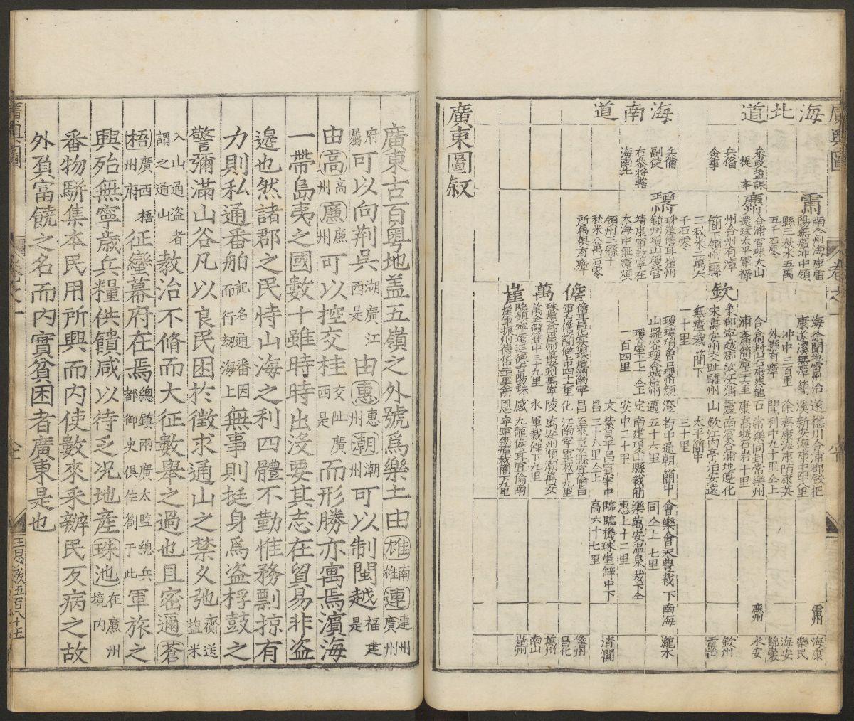
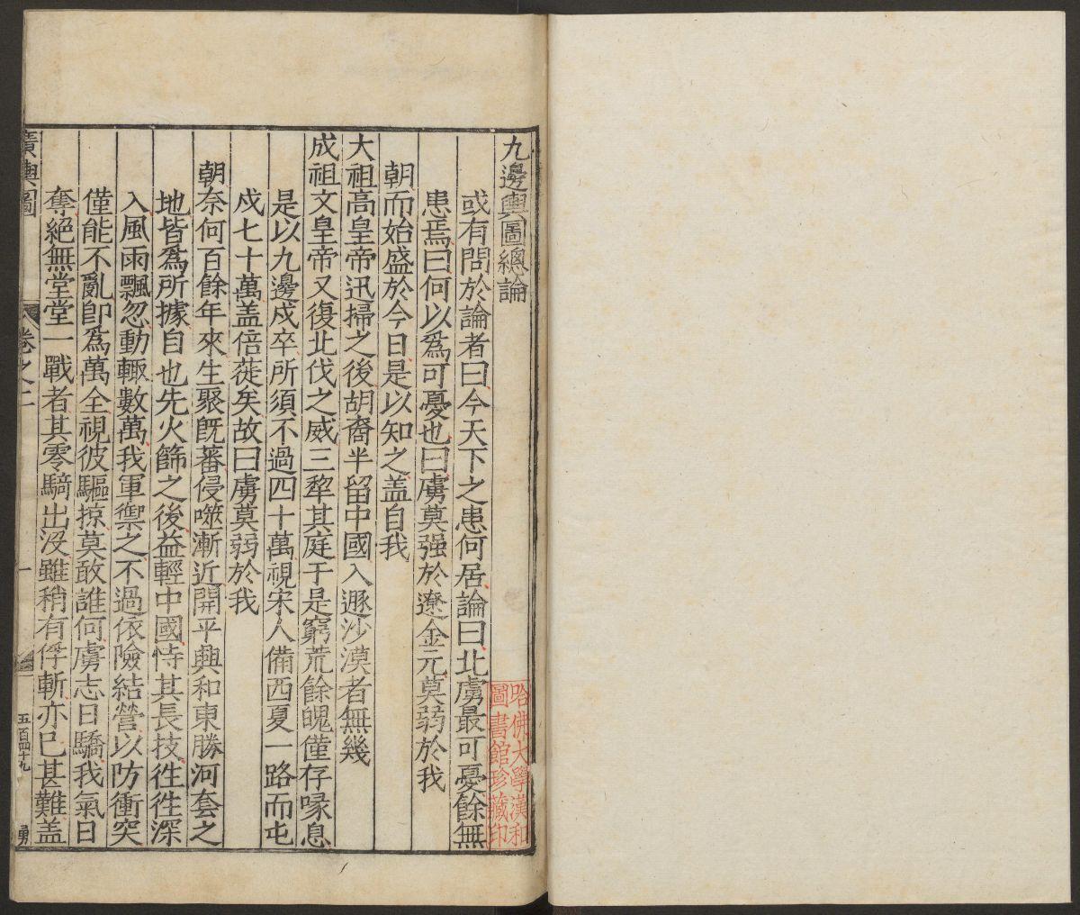
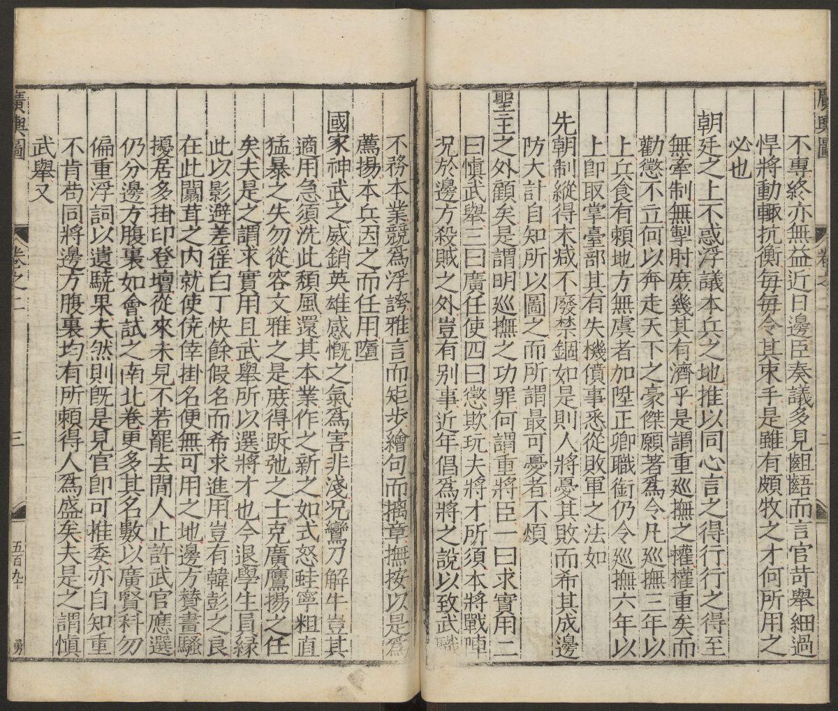
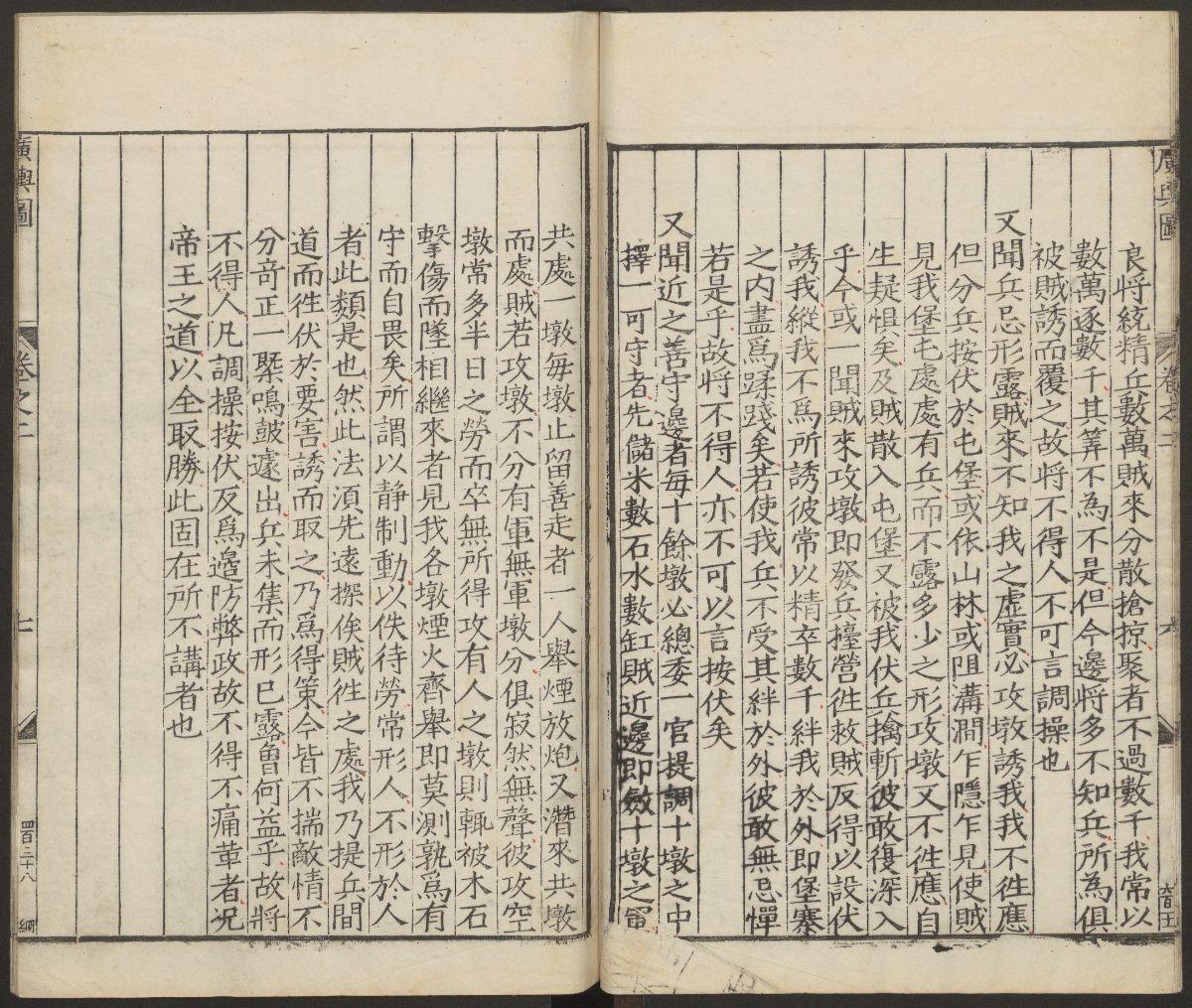
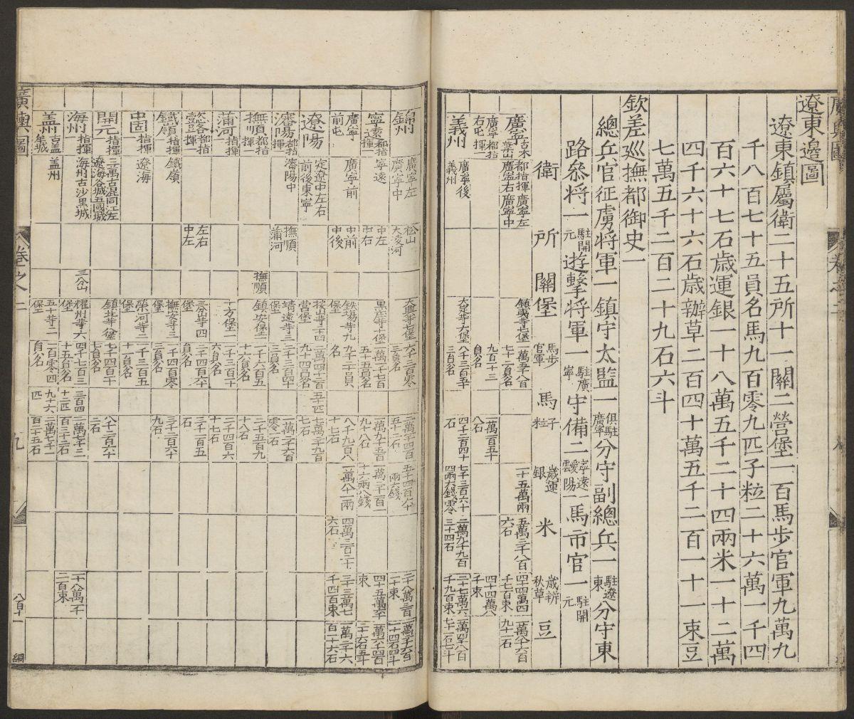
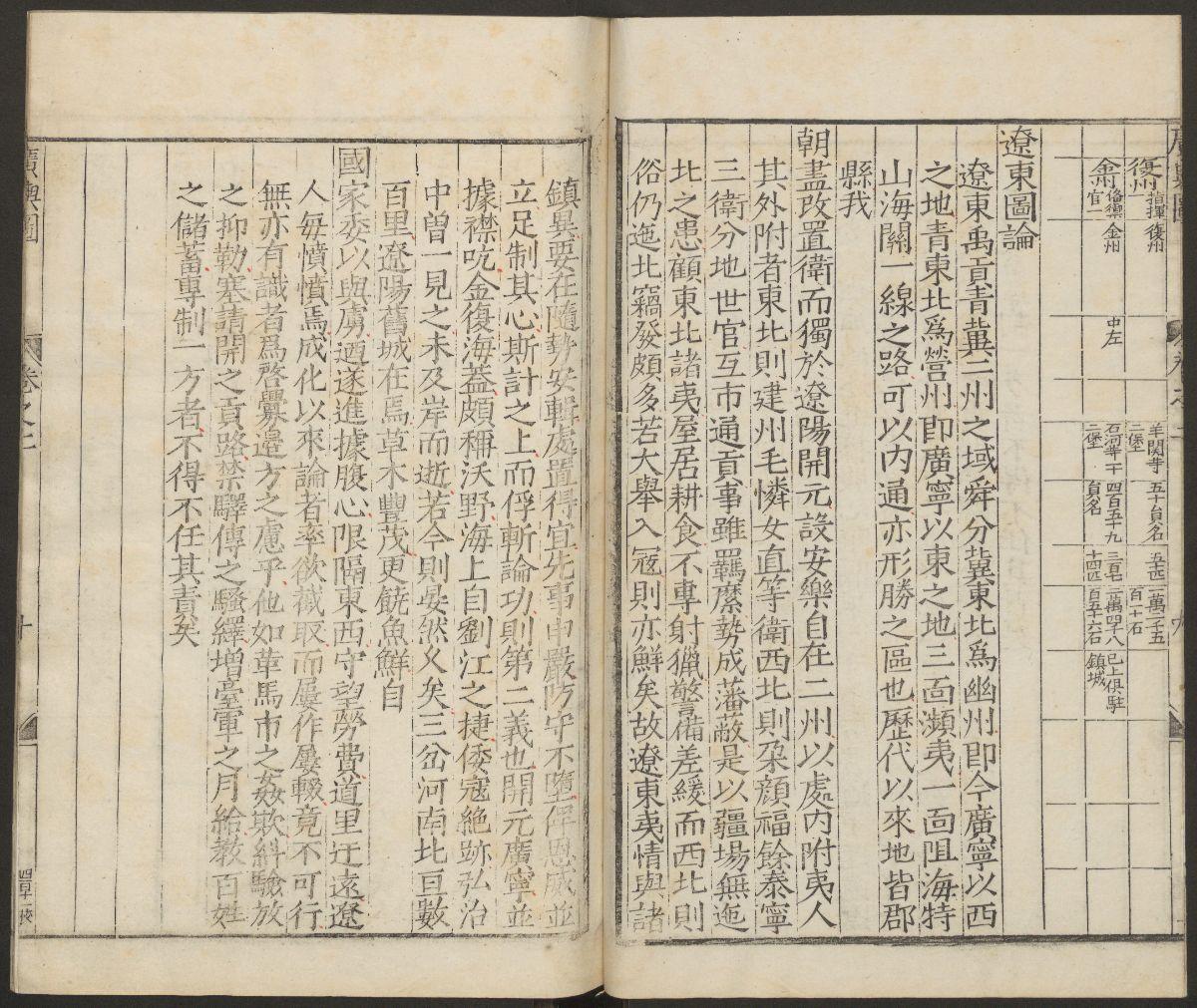
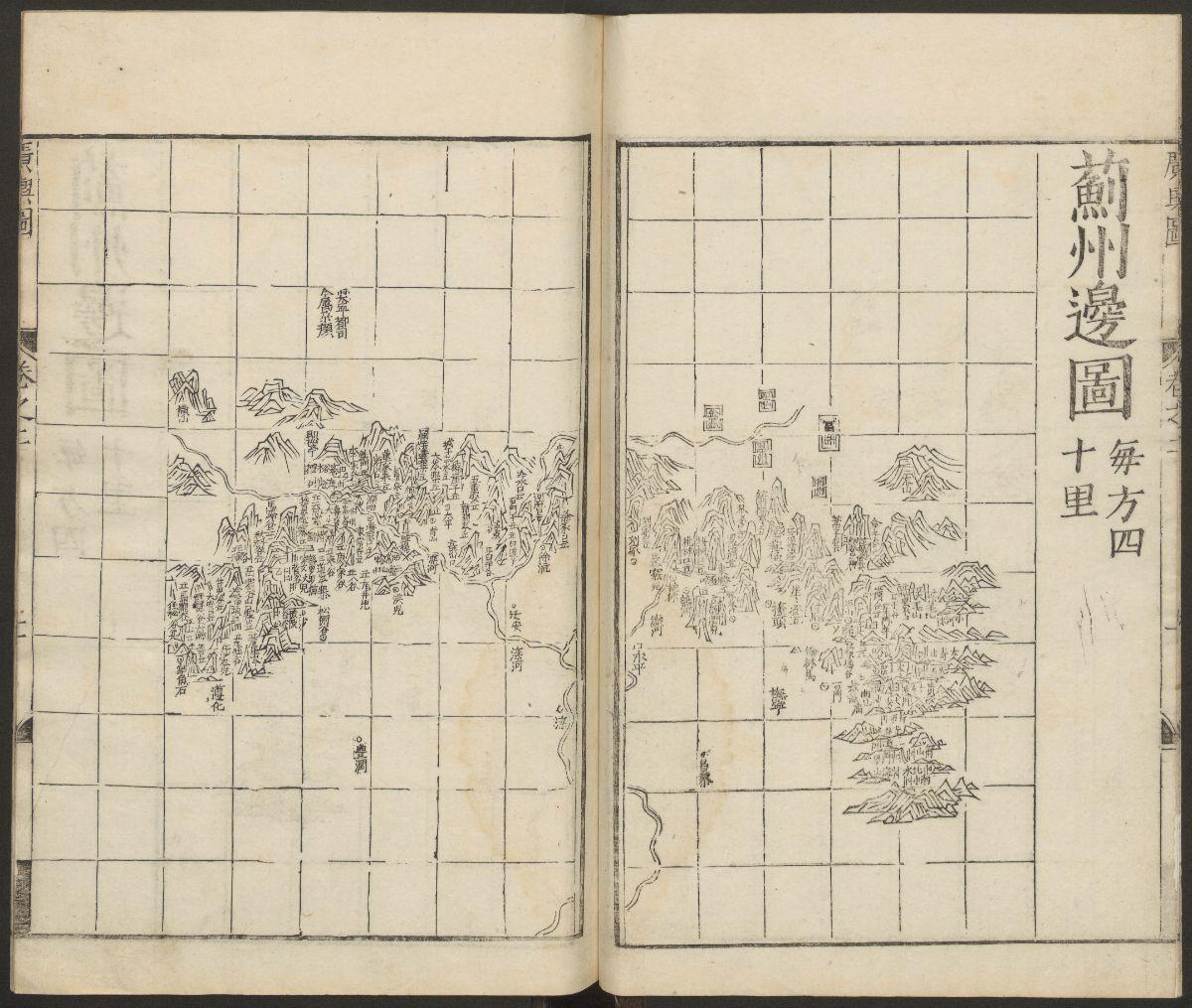
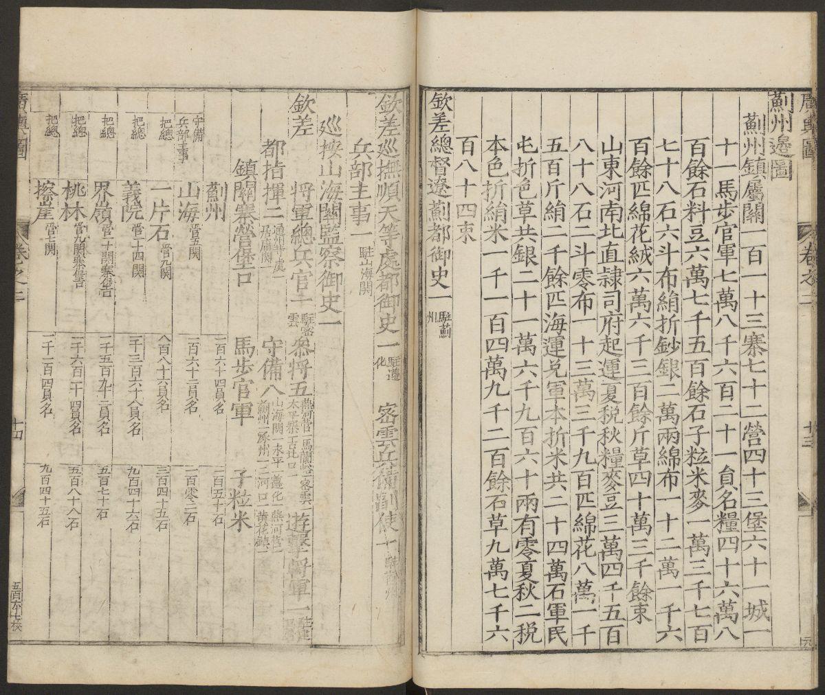
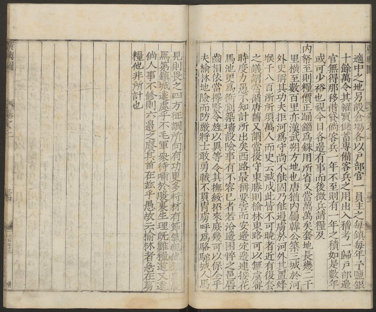
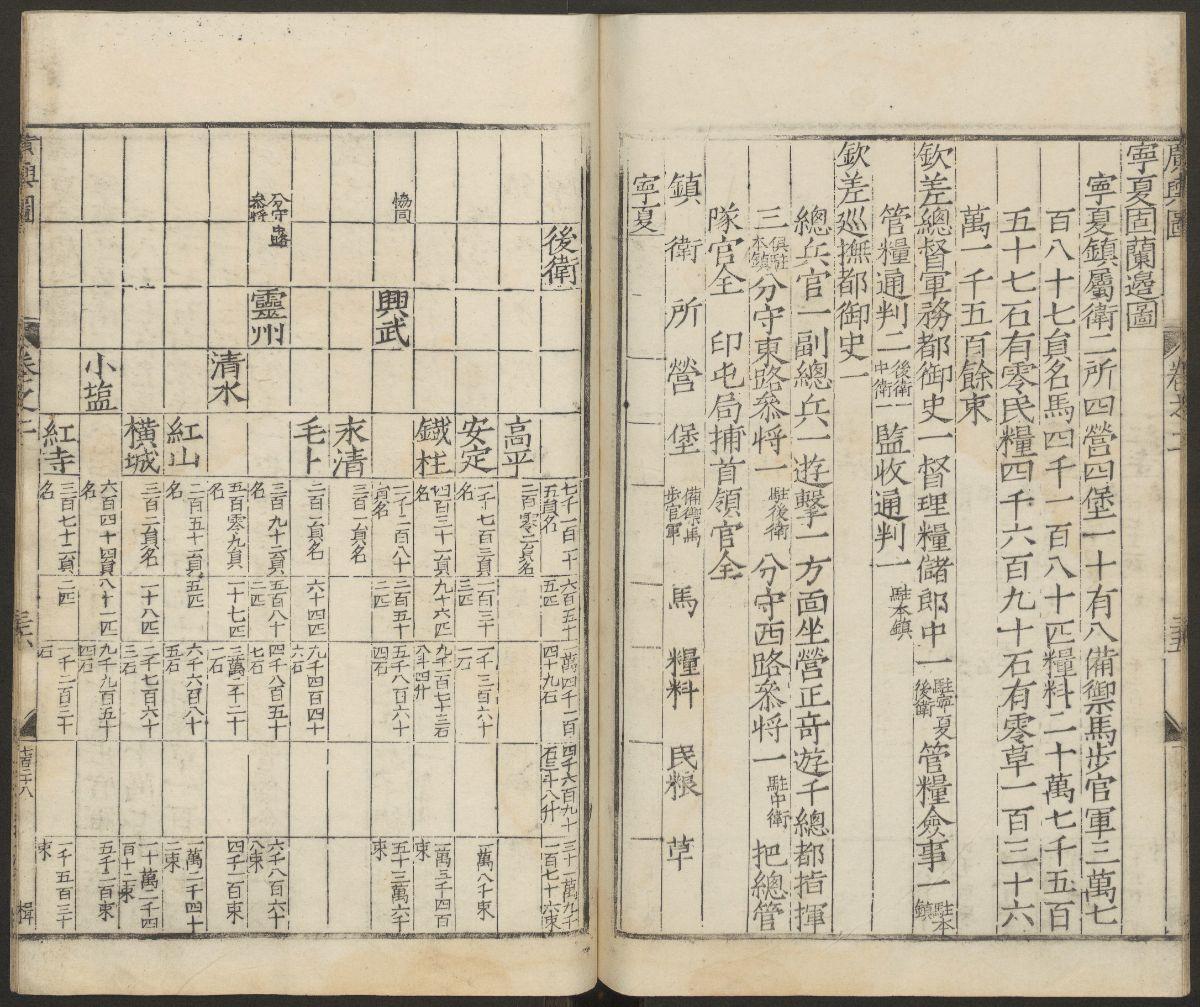
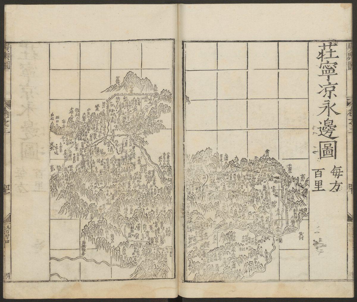
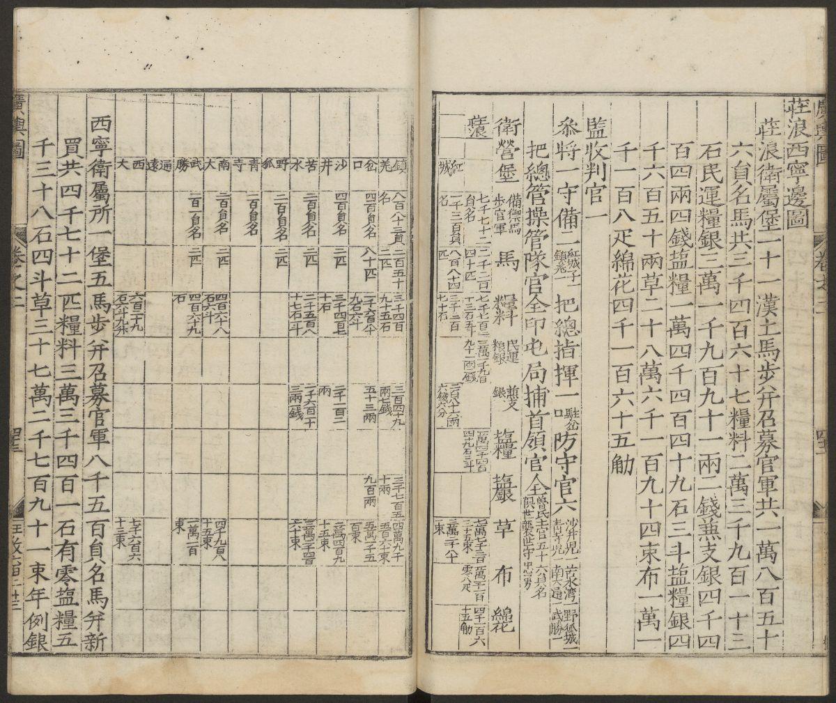
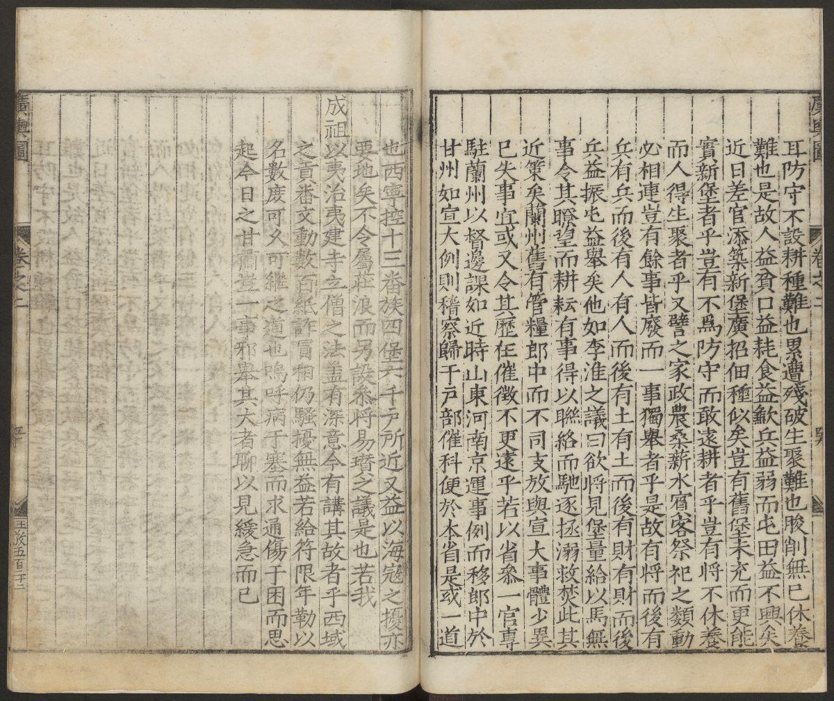
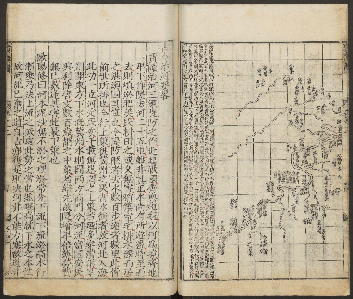
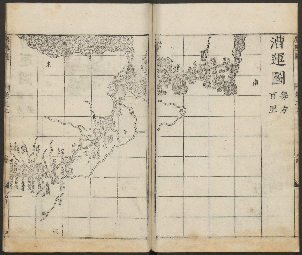
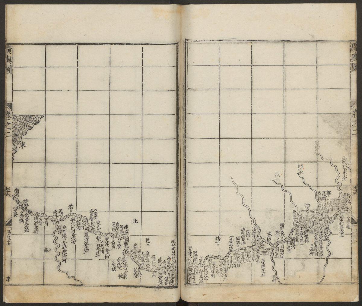
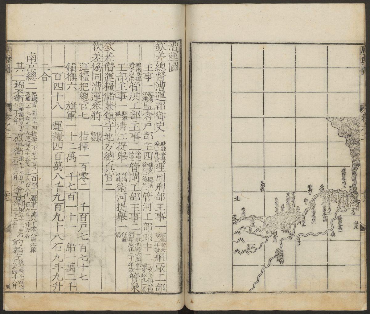
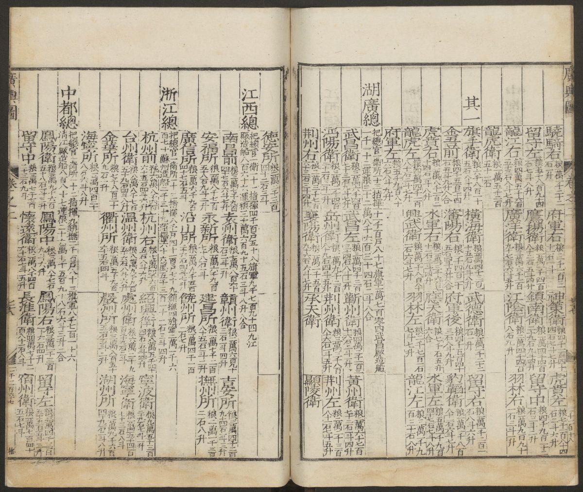
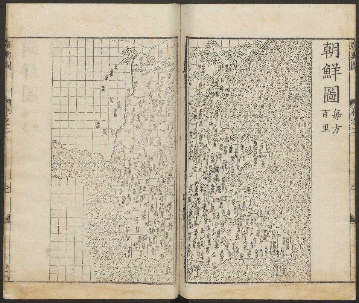
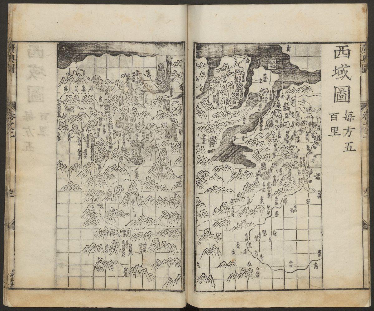
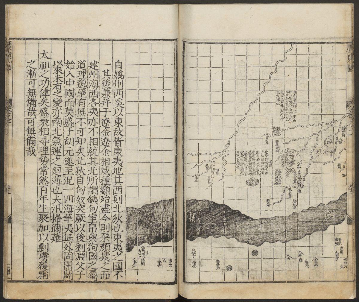
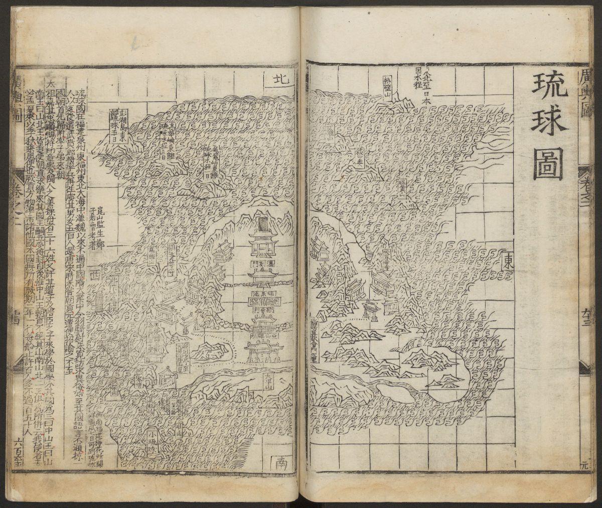
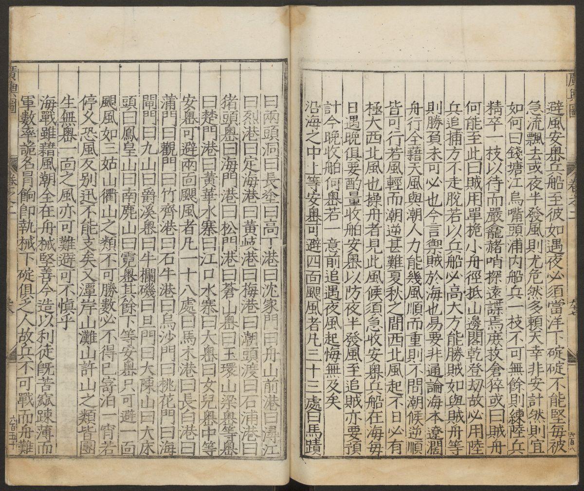
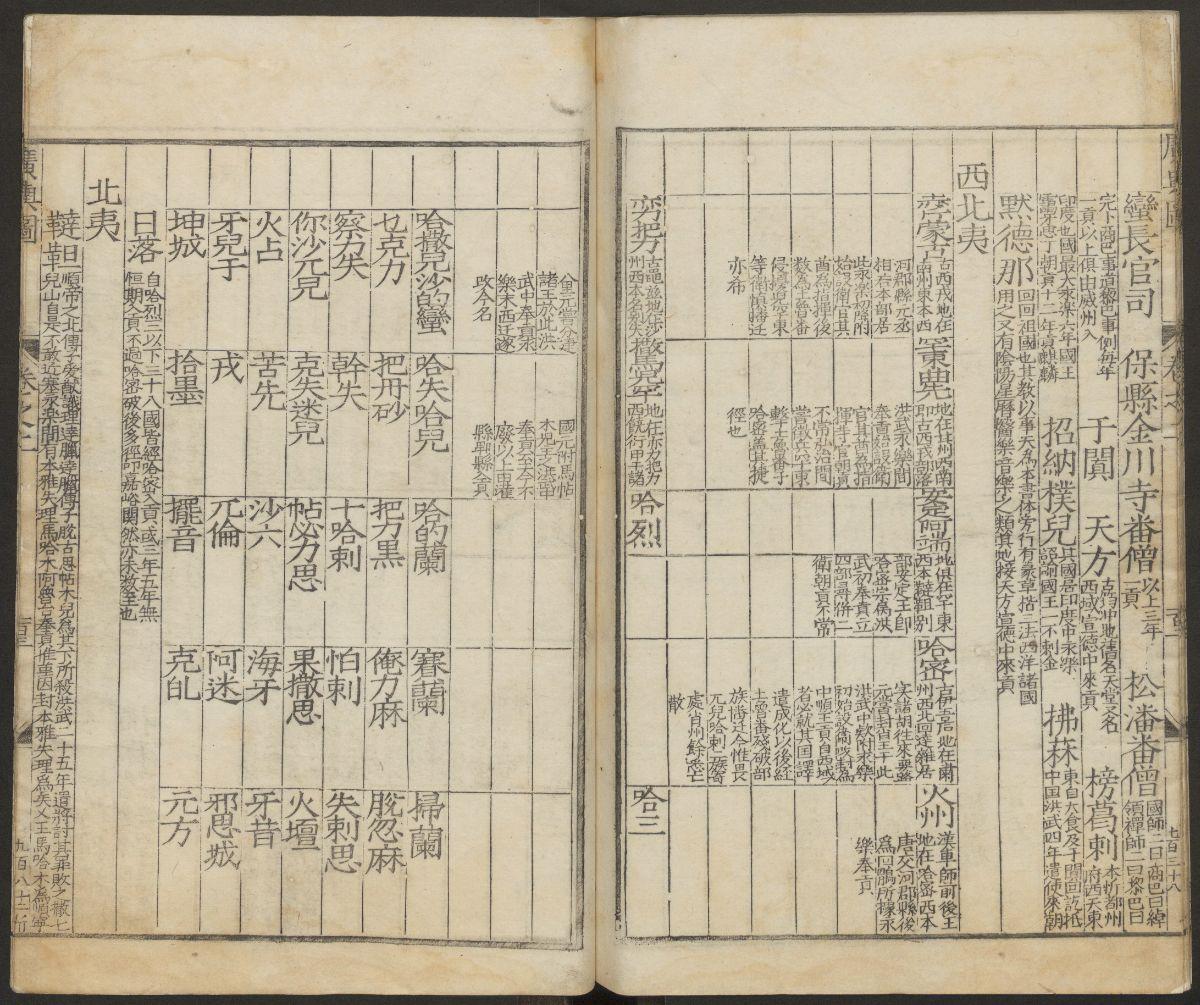
《广舆图》明代罗洪先根据元代朱思本的《舆地图》编绘。这是我国第一部综合性全国地图集。全书共两卷,其内容既包括政区图、边防图,又有专题图、周边地图及邻国地图,每幅地图后面都附有简短说明和解释图。此本为明万历7年(1579)海虞钱岱刊本,前有序七篇。
The Canton Map Volume II [Ming] Zhu Siben (1273-1335), Zhu Siben, Luo Hongxian, supplemented the publisher: Han Junen, Du Siming, 45 years of Jiajing (1556 AD)
Guangyu Map was compiled by Luo Hongxian of the Ming Dynasty based on the map of Zhu Siben of the Yuan Dynasty. This is China’s first comprehensive national atlas. The book consists of two volumes, including the map of the administrative region, the border map, the thematic map, the surrounding map and the map of neighboring countries. Each map is accompanied by a brief explanation and explanation map. This is the publication of Haiyu Qiandai in the 7th year of the Wanli reign of the Ming Dynasty (1579), with seven chapters in order.


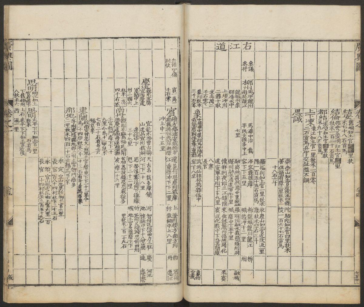


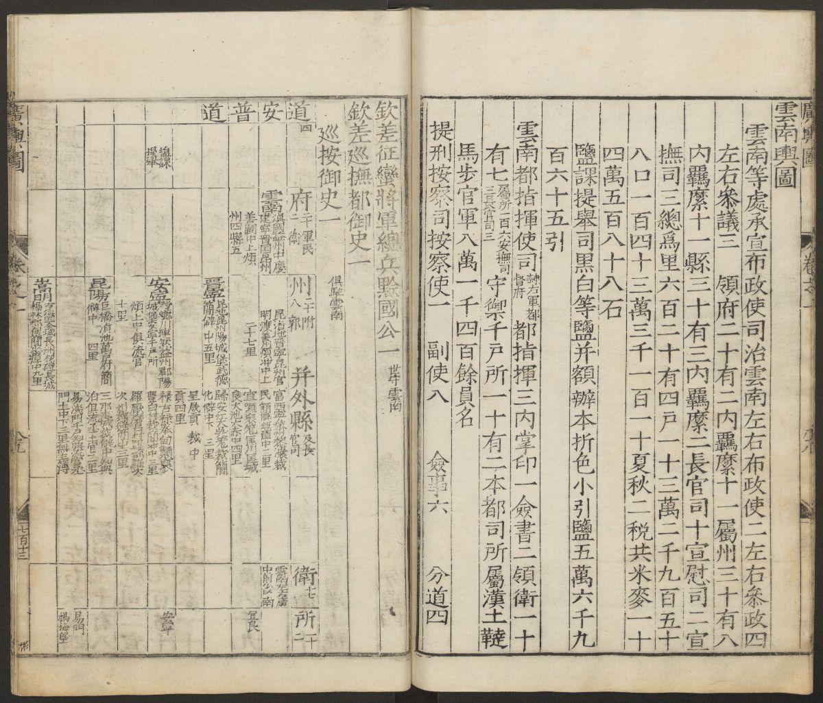

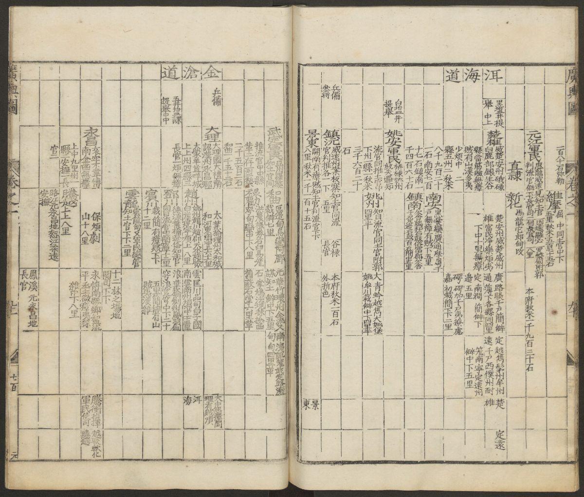
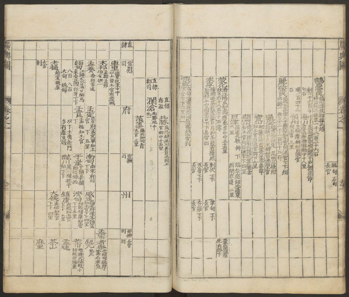


Record记录 Region地理 237P 《廣輿圖》二卷【明】朱思
历史上的今天 ( 0 ):
可点 ➠ 2023年-01月-29日 ➠ 68 s ➠ ♥ 0