

标签: 北京 有 11 篇
- Memory记忆:The Military Mediation Office from Beiping to Tianjin, China, 1947 中国北平—天津 军调处1947年(48P):2024年-01月-27日
- Memory记忆:Beijing, China 1948 中国北平1948年(239P):2024年-01月-10日
- Memory记忆:Beiping, China, 1947 中国北平·1947年(4P):2023年-12月-30日
- Memory记忆:Beijing, China 1946 中国北平1946年(28P):2023年-12月-10日
- Memory记忆:Skating Elderly in Beiping City, China, February 1946 中国北平市溜冰老人1946年2月(8P):2023年-11月-26日
- Memory记忆:Architectural Monuments in Beiping, China, 1946 中国北平 建筑古迹 ·1946年(47P):2023年-11月-18日
- Memory记忆:China · Beiping · Chiang Kai shek and Song Meiling · November 1945 中国·北平·蒋介石和宋美龄·1945年11月(11P):2023年-11月-06日
- Memory记忆:Beijing, China March 1989 中国北京1989年3月(68P):2023年-10月-29日
- Memory记忆:Beijing, China, 1984 北京·1984年(摄影师Thomashoepker)(7P):2023年-10月-29日
- Region地理:北京皇城图(3P):2022年-12月-24日
- Region地理:颐和园(28P):2022年-09月-11日
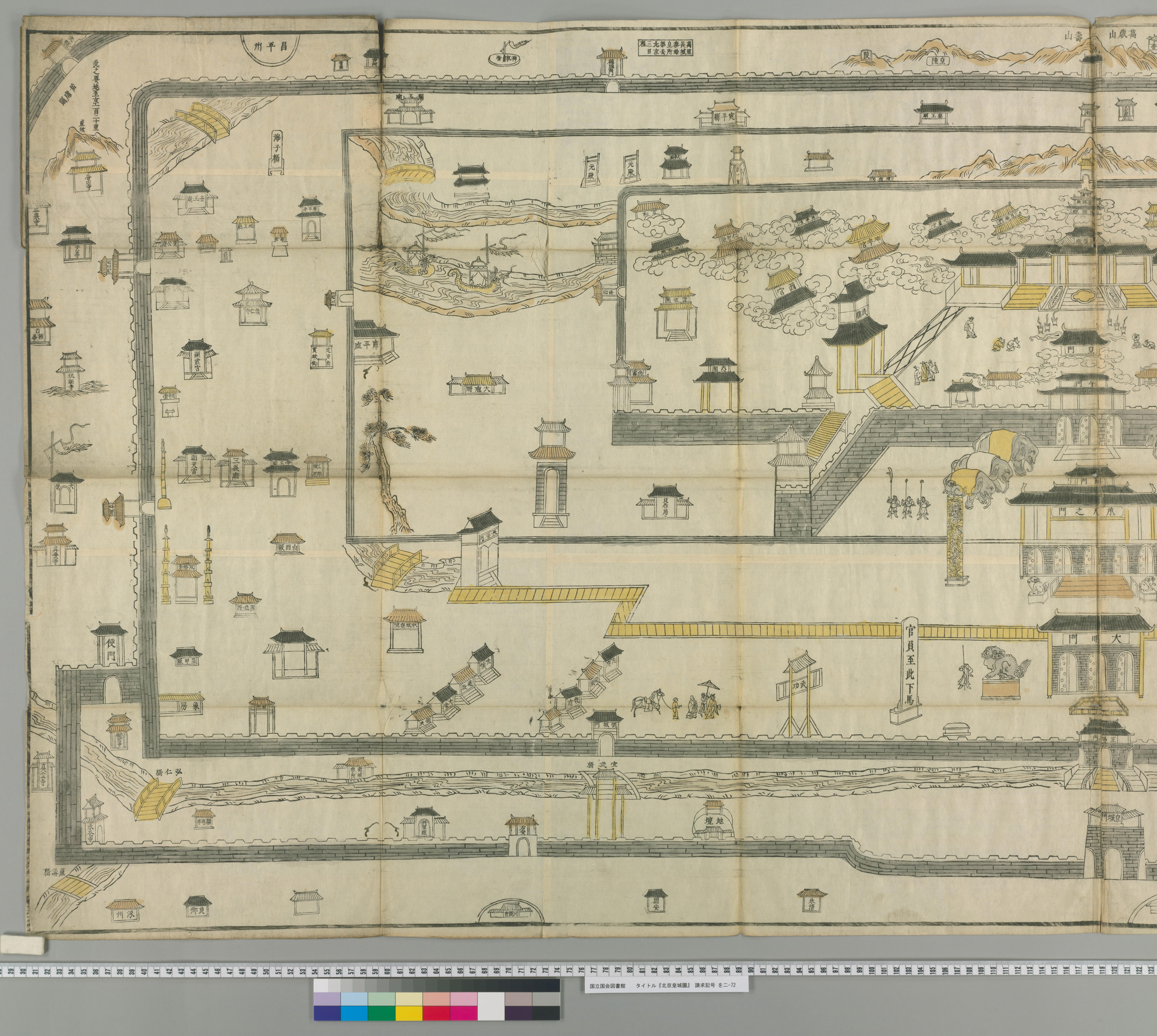
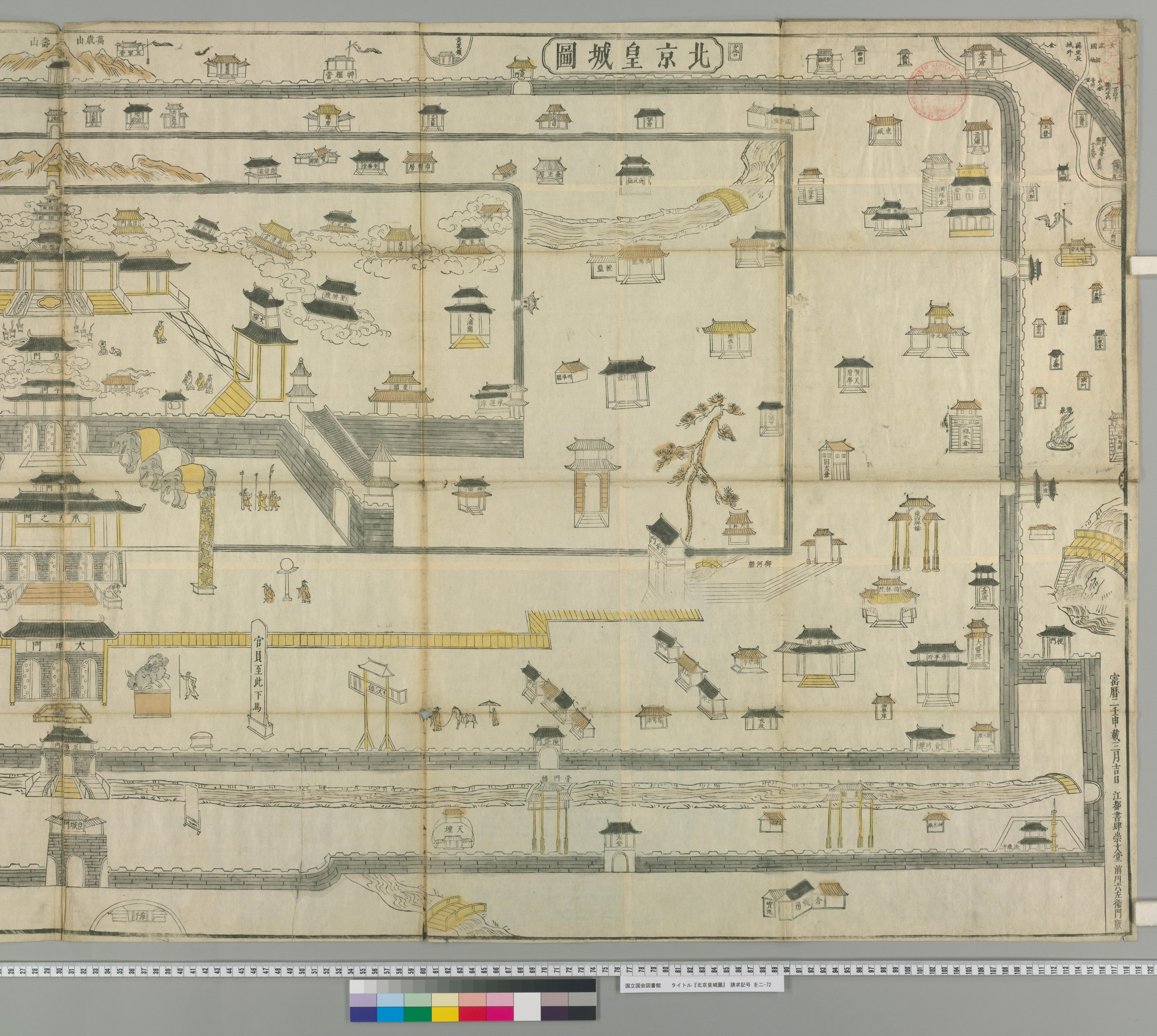
此《北京皇城图》选自日本舆图,日本江户时代绘制,可以看到地图上注明时间为日本宝历二年(日本桃园天皇,清乾隆十七年/1752年)壬申刻本。此《北京皇城图》描绘了明万历年间的北京皇城。
This Map of the Imperial City of Beijing is selected from the Japanese map, which was drawn in the Edo era of Japan. It can be seen that the map indicates the date as the Renshen engraving in the second year of the Baoli (Emperor Taoyuan of Japan, the 17th year of Qianlong’s reign in the Qing Dynasty/1752). This “The Painting of the Imperial City of Beijing” depicts the imperial city of Beijing during the Wanli period of the Ming Dynasty.
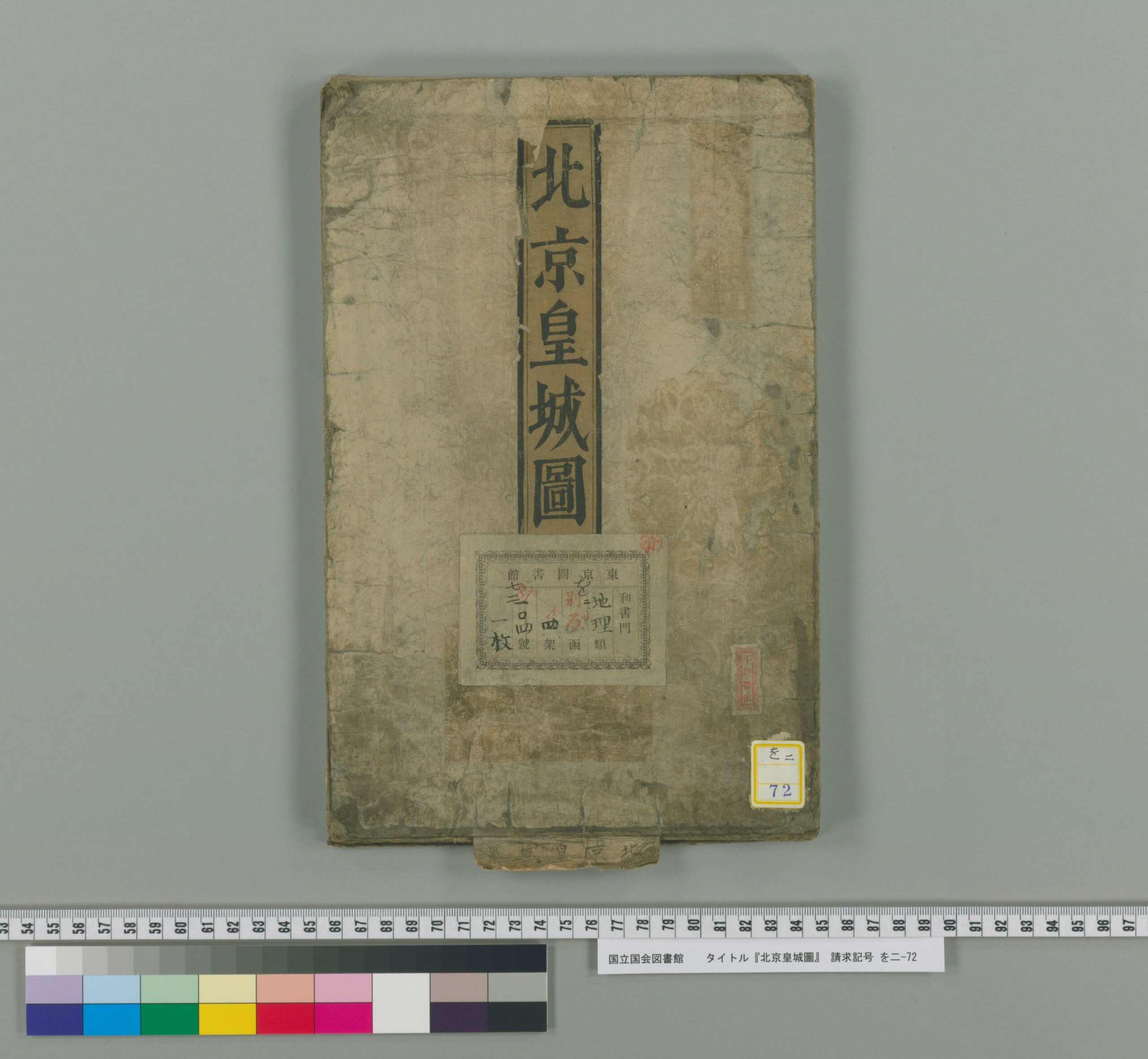
Record记录 Region地理 3P 北京皇城图
上一篇:
历史上的今天 ( 26 ):
- 2023年-12月-24日:NDS:ARALE 阿拉蕾
- 2023年-12月-24日:NDS:Alice in Wonderland 爱丽丝梦游仙境
- 2023年-12月-24日:NDS:Super Lite 2500 Gekikara Nanpure 2500-Mon SuperLite2500 激辣数独2500问
- 2023年-12月-24日:NDS:SuperLite2500 - Crimson Room Super Lite 2500 绯红房间
- 2023年-12月-24日:NDS:SuperLite2500 - Tokyo Odaiba Casino 东京台场赌场
- 2023年-12月-24日:Video视频:酒吧不雅一幕,坐着尿尿
- 2023年-12月-24日:Video视频:终于全款买下,心仪已久充气娃娃
- 2023年-12月-24日:Video视频:飞利浦吸奶器,视频说明
- 2023年-12月-24日:Video视频:不懂事小猴子,玩小弟弟
- 2023年-12月-24日:Video视频:酒吧没有冬天,穿的都很少
- 2023年-12月-24日:Video视频:性感美女,一次看个够
- 2023年-12月-24日:Video视频:身材葫芦娃美女,跳舞好看
- 2023年-12月-24日:Video视频:泰国人妖,太可怕了
- 2023年-12月-24日:Video视频:美女到哪里,哪里有故事
- 2023年-12月-24日:Video视频:这么隐蔽的KTV,得查查
- 2023年-12月-24日:Video视频:这颜值,是可以全天接单
- 2023年-12月-24日:Video视频:一个男人出轨一个男人
- 2023年-12月-24日:Video视频:猩猩走路为啥没声音
- 2023年-12月-24日:Video视频:冰天雪地,车祸连连
- 2023年-12月-24日:Video视频:美女圣诞节的寂寞
- 2023年-12月-24日:Video视频:胸部大胖子,跳舞妖娆
- 2023年-12月-24日:Video视频:老婆半夜醒来,看电视
- 2023年-12月-24日:Video视频:夜深了,老婆还不想睡
- 2023年-12月-24日:Video视频:黑丝的诱惑,儿童不宜
- 2023年-12月-24日:Video视频:哪个大学,大会放情爱片
- 2023年-12月-24日:News新闻:2023年12月24日新闻简报(国内国际)
可点 ➠ 2022年-12月-24日 ➠ 49 s ➠ ♥ 0