

- 2024年-02月-16日:唐土名胜图会.初集.6卷(88P)
- 2024年-02月-16日:唐土名胜图会.初集.5卷(75P)
- 2024年-02月-16日:唐土名胜图会.初集.4卷(78P)
- 2024年-02月-16日:唐土名胜图会.初集.3卷(87P)
- 2024年-02月-16日:唐土名胜图会.初集.2卷(54P)
- 2024年-02月-16日:唐土名胜图会.初集.1卷(62P)
- 2024年-01月-13日:彩图版《中国国家地理百科全书》6、青海、宁夏、新疆、香港(106P)
- 2024年-01月-13日:彩图版《中国国家地理百科全书》5、四川、贵州、云南、西藏(122P)
- 2024年-01月-13日:彩图版《中国国家地理百科全书》4、湖北、湖南、广东、广西(106P)
- 2024年-01月-13日:彩图版《中国国家地理百科全书》3、浙江、安徽、福建、江西(106P)
- 2024年-01月-13日:彩图版《中国国家地理百科全书》2、内蒙古、辽宁、吉林、黑龙(106P)
- 2024年-01月-13日:彩图版《中国国家地理百科全书》1、总论、北京、天津、河北(105P)
- 2024年-01月-13日:《中国景色·彩图版》作者:单之蔷(385P)
- 2023年-12月-16日:宣大山西三镇图说.三卷.明.杨时宁编.景明万历时期刊本.玄览堂丛书.1941年(303P)
- 2023年-12月-16日:渝城图.约绘于1850-1900年.法国国家图书馆藏(12P)
- 2023年-12月-16日:行宫座落图.扬州名胜图.江南名胜图.四册.清代刊本(110P)
- 2023年-12月-16日:异域图志.一卷.剑桥大学图书馆藏.明刊孤本(206P)
- 2023年-09月-24日:泛槎图.含续泛槎图等.全集.清张宝撰.道光时期羊城尚古斋刊刻(500P)
- 2023年-09月-24日:法军远征在埃及考察研究作品集之埃及自然史板画(253P)
- 2023年-09月-21日:新镌海内奇观·六册(60P)
- 2023年-09月-21日:新镌海内奇观·五册(59P)
- 2023年-09月-21日:新镌海内奇观·四册(63P)
- 2023年-09月-21日:新镌海内奇观·三册(72P)
- 2023年-09月-21日:新镌海内奇观·二册(47P)
- 2023年-09月-21日:新镌海内奇观·一册(66P)
- 2023年-06月-14日:百幕大未解之谜(181P)
- 2023年-06月-14日:雍和宫集(1~20)(68P)
- 2023年-04月-25日:故宫宽幅照片(48P)
- 2023年-04月-14日:世界美术全集:建筑卷(97P)
- 2023年-04月-08日:中国建筑艺术史 (下册)(665P)
- 2023年-04月-08日:中国建筑艺术史 (上册)(584P)
- 2023年-04月-08日:建筑装修与装饰·中国建筑艺术全集 24(242P)
- 2023年-04月-05日:宅第建筑 4 南方少数民族·中国建筑艺术全集 23(330P)
- 2023年-04月-05日:宅第建筑 3 北方少数民族·中国建筑艺术全集 22(219P)
- 2023年-03月-27日:游遍世界(172P)
- 2023年-03月-27日:宅第建筑 2 南方汉族·中国建筑艺术全集 21(333P)
- 2023年-03月-27日:佛教建筑(2)(南方) (丁承樸)·中国建筑艺术全集(319P)
- 2023年-03月-23日:游遍中国(172P)
- 2023年-03月-16日:宅第建筑1 北方汉族·中国建筑艺术全集 20(325P)
- 2023年-03月-16日:风景建筑·中国建筑艺术全集 19(320P)
- 2023年-03月-10日:私家园林·中国建筑艺术全集 18(328P)
- 2023年-03月-10日:皇家园林·中国建筑艺术全集 17(249P)
- 2023年-03月-05日:道教建筑·中国建筑艺术全集 15(318P)
- 2023年-03月-05日:会馆建筑·祠堂建筑·中国建筑艺术全集 11(299P)
- 2023年-03月-02日:书院建筑·中国建筑艺术全集 10(320P)
- 2023年-03月-02日:坛庙建筑·中国建筑艺术全集 9(333P)
- 2023年-02月-28日:泰晤士世界历史地图集(360P)
- 2023年-02月-27日:清代陵墓建筑·中国建筑艺术全集 8(280P)
- 2023年-02月-27日:明代陵墓建筑·中国建筑艺术全集 7(328P)
- 2023年-02月-25日:元代前陵墓建筑·中国建筑艺术全集 6(313P)
- 2023年-02月-25日:桥梁、水利建筑·中国建筑艺术全集 5(334P)
- 2023年-02月-24日:古代城镇·中国建筑艺术全集 4(317P)
- 2023年-02月-24日:宫殿建筑(3) 沈阳·中国建筑艺术全集(312P)
- 2023年-02月-24日:宫殿建筑(2)(北京)·中国建筑艺术全集(311P)
- 2023年-02月-24日:宫殿建筑(1)(北京)·中国建筑艺术全集(247P)
- 2023年-02月-09日:镇江胜境图暨乾隆御题诗刻.清高宗弘历撰并书.民国拓本(6P)
- 2023年-02月-07日:西湖佳景.湖上扶摇子辑.彩色图绘套印本.1750(22P)
- 2023年-02月-04日:亚细亚大观.照片.亚细亚写-真大观社编.1935-1942(396P)
- 2023年-01月-29日:韩国舆地图.金鸿圭模绘.1893(13P)
- 2023年-01月-29日:《廣輿圖》二卷【明】朱思(237P)
- 2023年-01月-27日:古今历代中华地图(16P)
- 2023年-01月-17日:江戸絵図.鍬形紹真画(6P)
- 2023年-01月-13日:中國博物館藏畫.上海博物館藏畫(128P)
- 2023年-01月-12日:万国博覧会日本館仮図案(25P)
- 2023年-01月-03日:江苏至北京运河全图(13P)
- 2022年-12月-31日:東京真画名所図解.井上探景画(22P)
- 2022年-12月-29日:岸圃大观.乾坤.明彭汝楠辑.崇祯11刊(37P)
- 2022年-12月-24日:Matrícula de tributos.墨西哥.贡品录(32P)
- 2022年-12月-24日:北京皇城图(3P)
- 2022年-12月-17日:海底世界 珊瑚礁和鱼类的天堂(368P)
- 2022年-12月-15日:第八册(清时期)中国历史地图集(142P)
- 2022年-12月-15日:第七册(元 明)中国历史地图集(193P)
- 2022年-12月-15日:第六册(宋辽金)中国历史地图集(131P)
- 2022年-12月-15日:第五册(隋唐五代)中国历史地图集(150P)
- 2022年-12月-14日:第四册(南北朝)中国历史地图集(108P)
- 2022年-12月-14日:第三册(魏晋)中国历史地图集(91P)
- 2022年-12月-14日:第二册(秦汉)中国历史地图集(101P)
- 2022年-12月-14日:第一册(先秦)中国历史地图集(92P)
- 2022年-12月-10日:中国地方志辞典之二(405P)
- 2022年-12月-10日:中国地方志辞典之一(400P)
- 2022年-12月-04日:[典藏国家地理:中国版(下)].龚勋.全彩版(113P)
- 2022年-12月-04日:[典藏国家地理:中国版(中)].龚勋.全彩版(113P)
- 2022年-12月-04日:[典藏国家地理:中国版(上)].龚勋.全彩版(113P)
- 2022年-11月-23日:地理龙穴扼要 第10册(133P)
- 2022年-11月-23日:地理龙穴扼要 第9册(147P)
- 2022年-11月-23日:地理龙穴扼要 第8册(109P)
- 2022年-11月-23日:地理龙穴扼要 第7册(119P)
- 2022年-11月-22日:地理龙穴扼要 第6册(101P)
- 2022年-11月-22日:地理龙穴扼要 第5册(97P)
- 2022年-11月-21日:地理龙穴扼要 第4册(157P)
- 2022年-11月-21日:地理龙穴扼要 第3册(87P)
- 2022年-11月-20日:地理龙穴扼要 第2册(156P)
- 2022年-11月-20日:地理龙穴扼要 第1册(128P)
- 2022年-11月-07日:世界经济地理(245P)
- 2022年-11月-03日:环球国家地理百科全书之七(214P)
- 2022年-11月-03日:环球国家地理百科全书之六(400P)
- 2022年-11月-03日:环球国家地理百科全书之五(400P)
- 2022年-11月-03日:环球国家地理百科全书之四(400P)
- 2022年-11月-03日:环球国家地理百科全书之三(400P)
- 2022年-11月-03日:环球国家地理百科全书之二(400P)
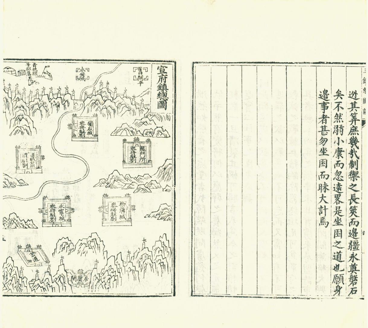
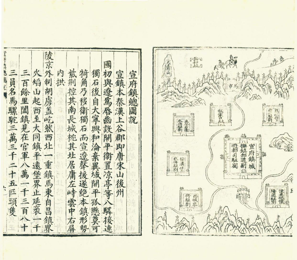
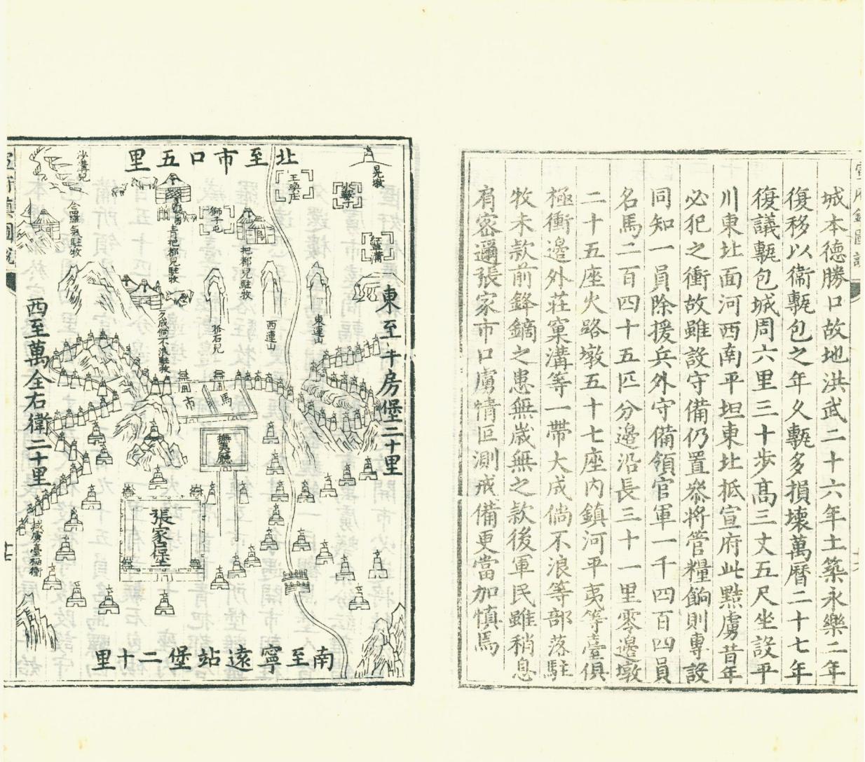
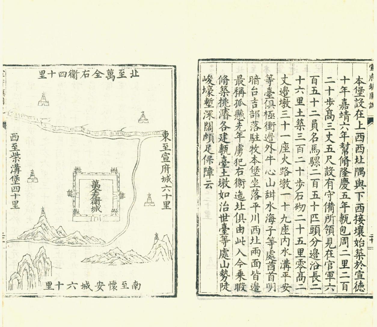
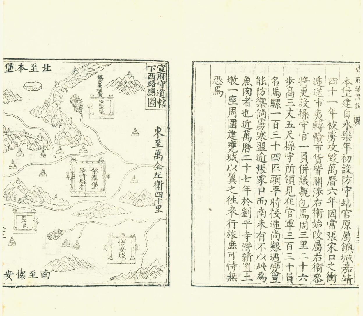
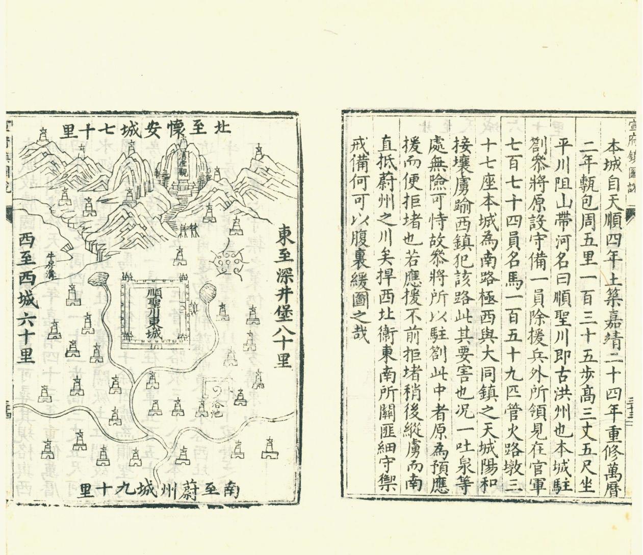
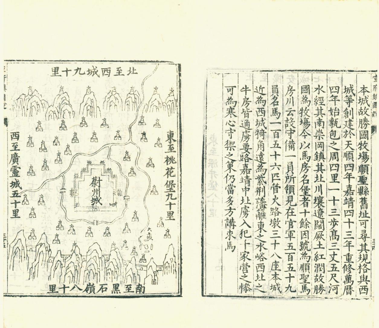
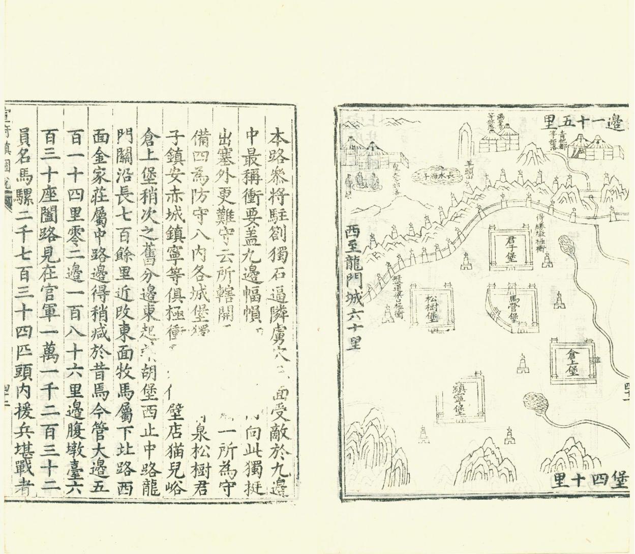
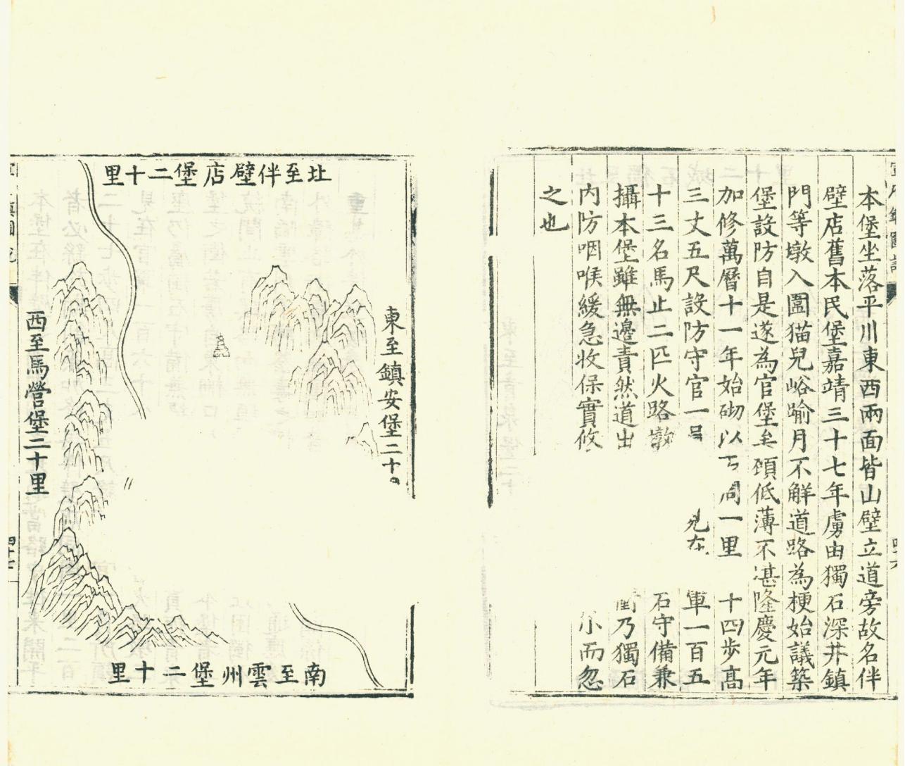
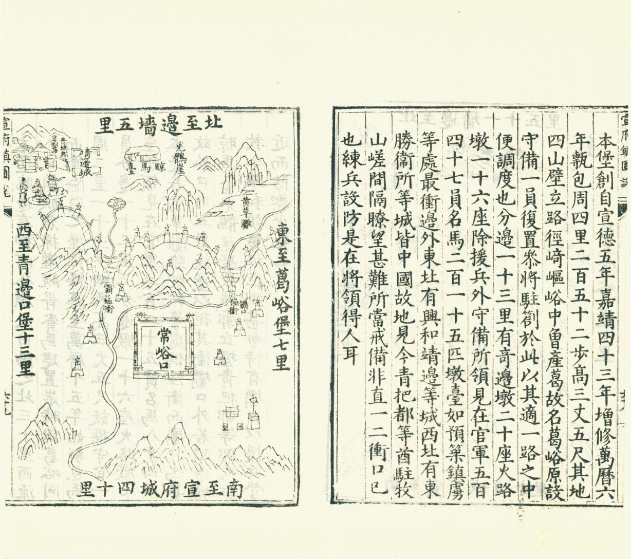
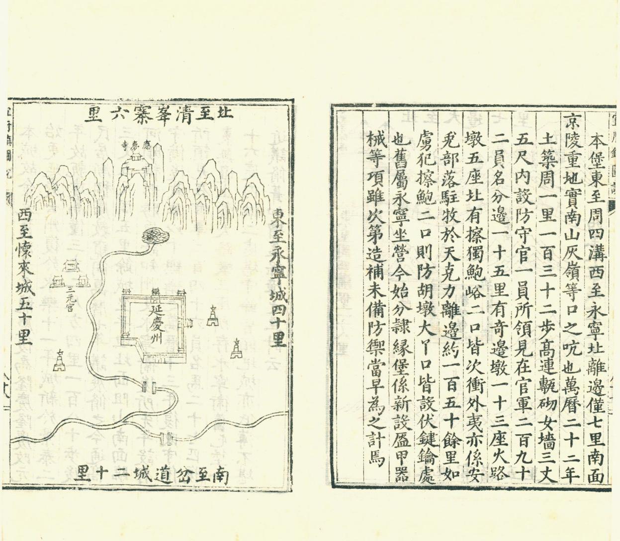
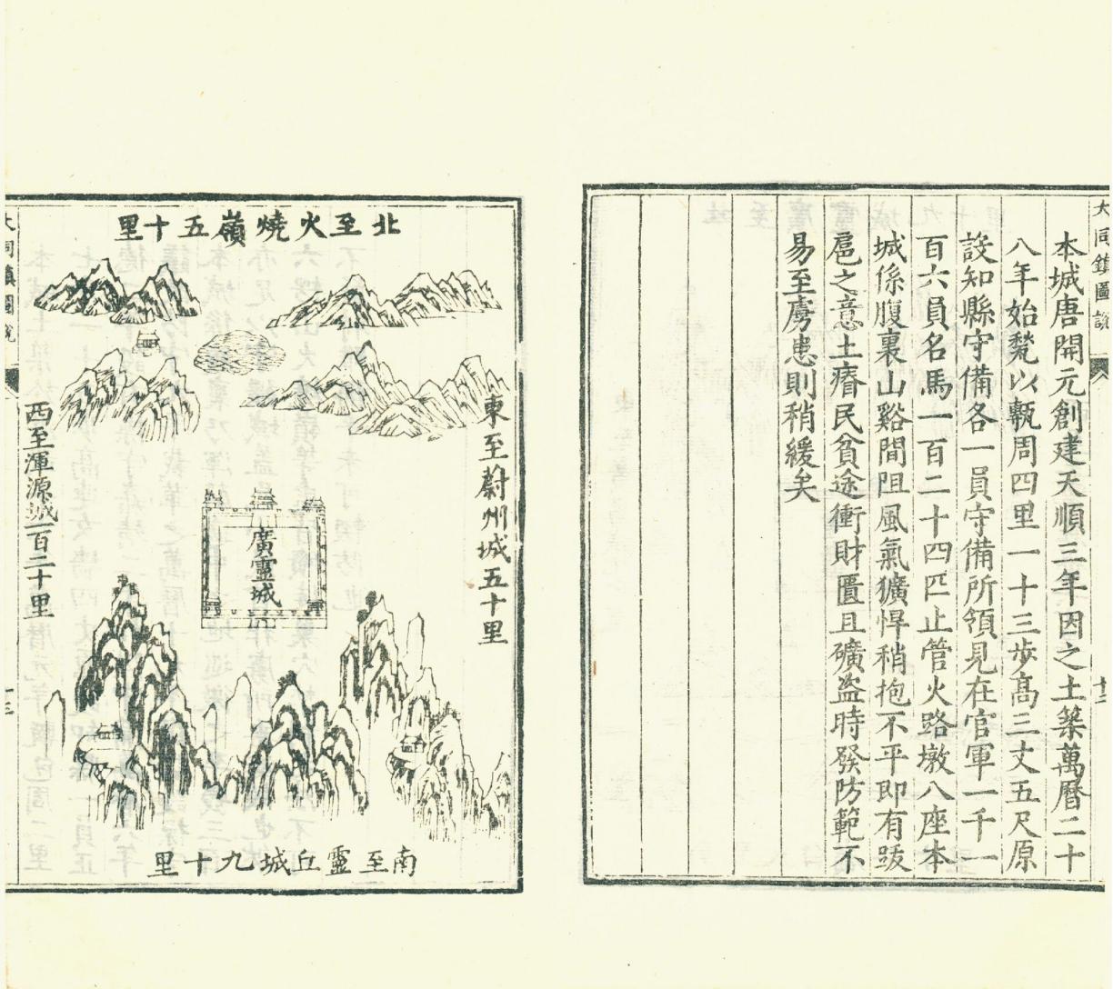
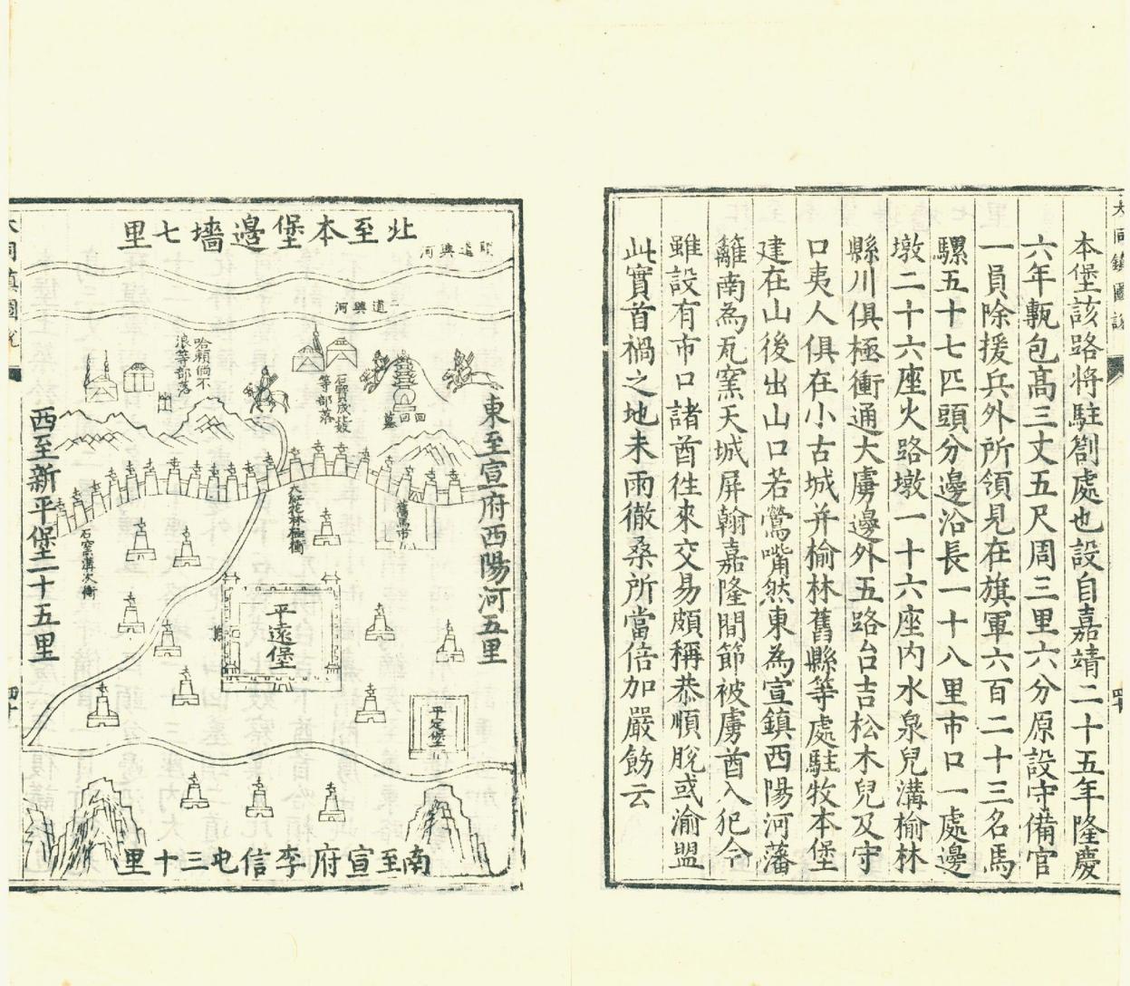
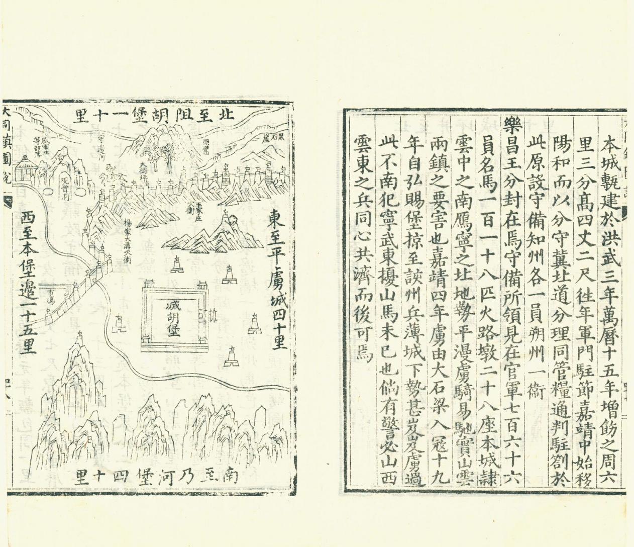
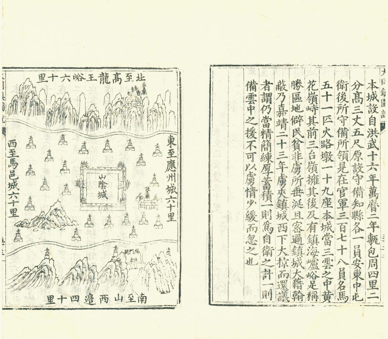
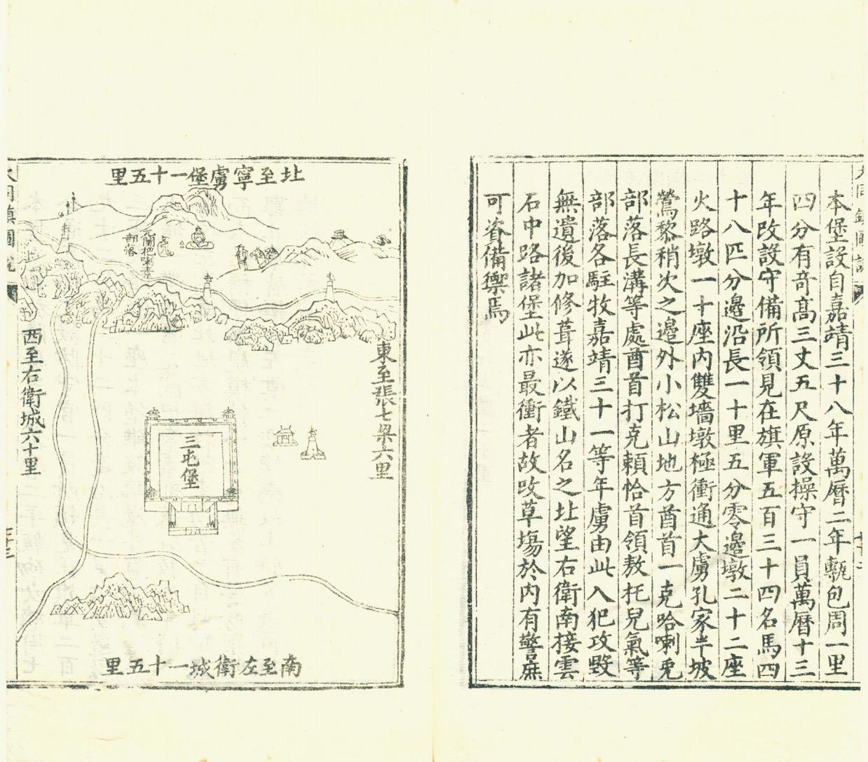
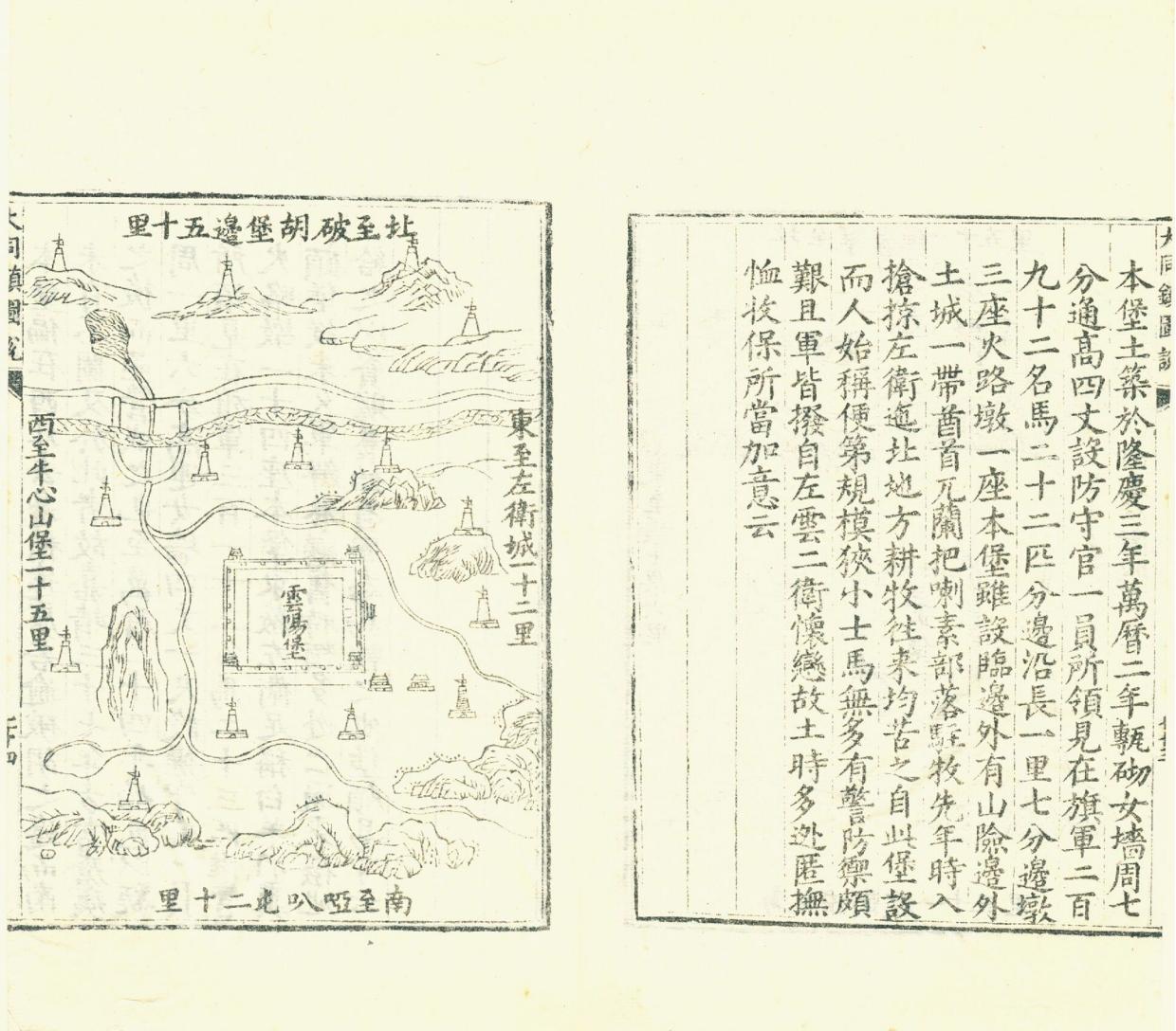
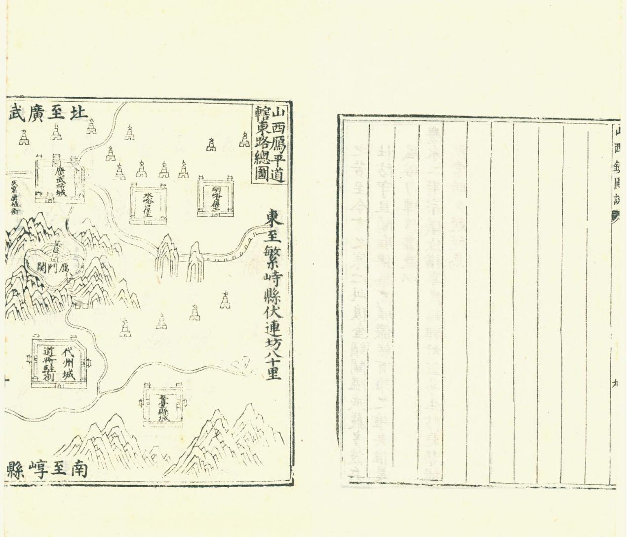
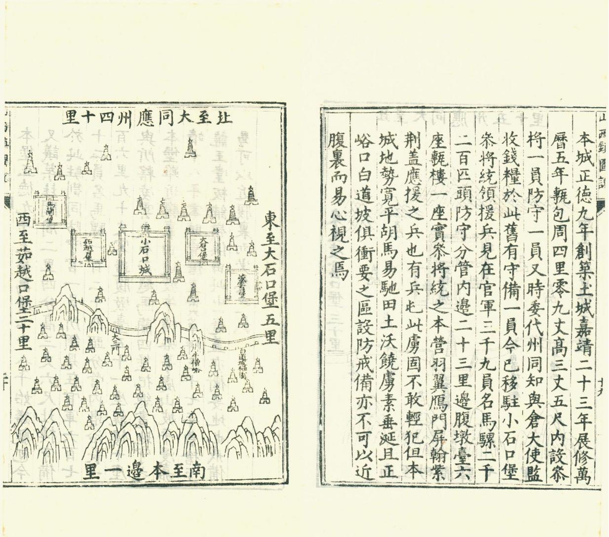
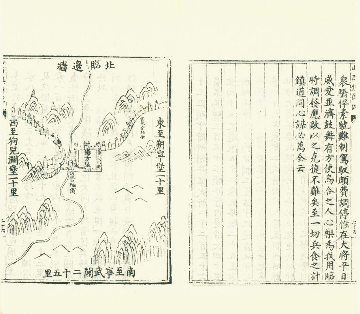
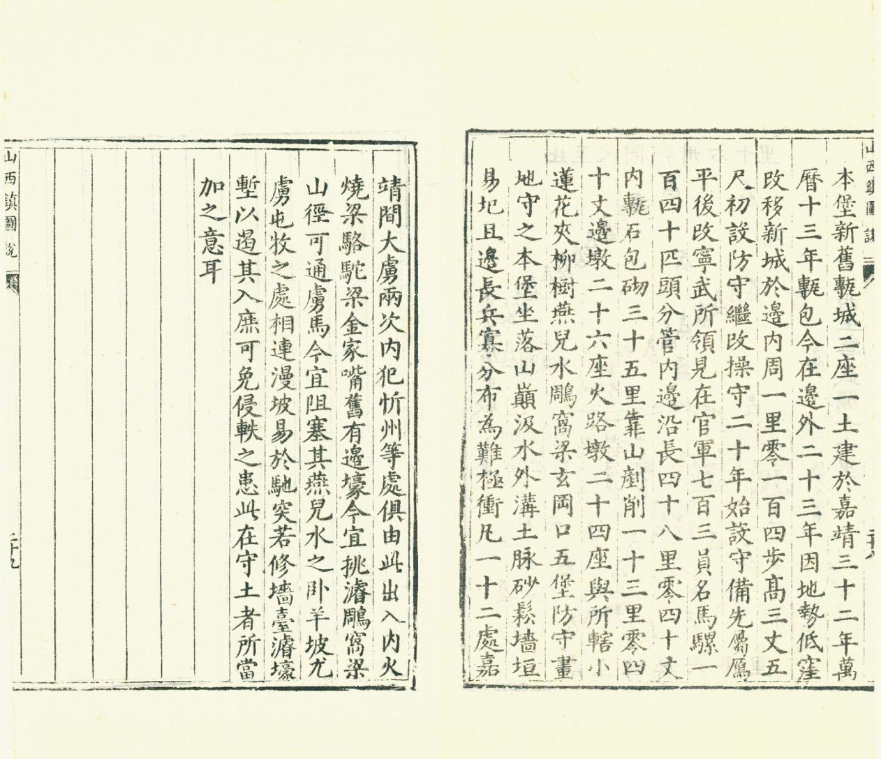
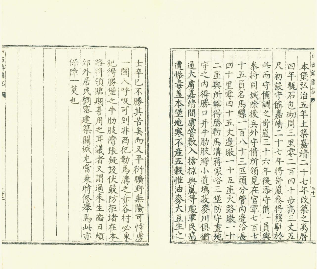
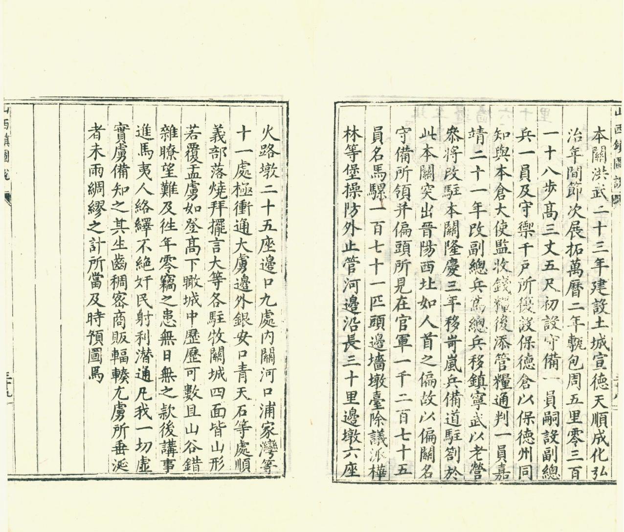
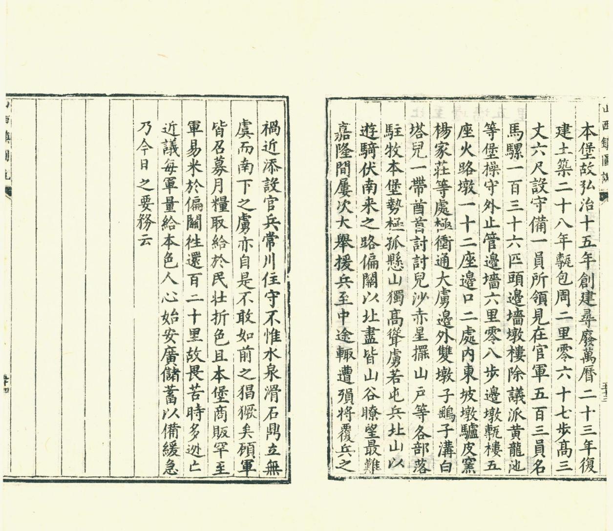
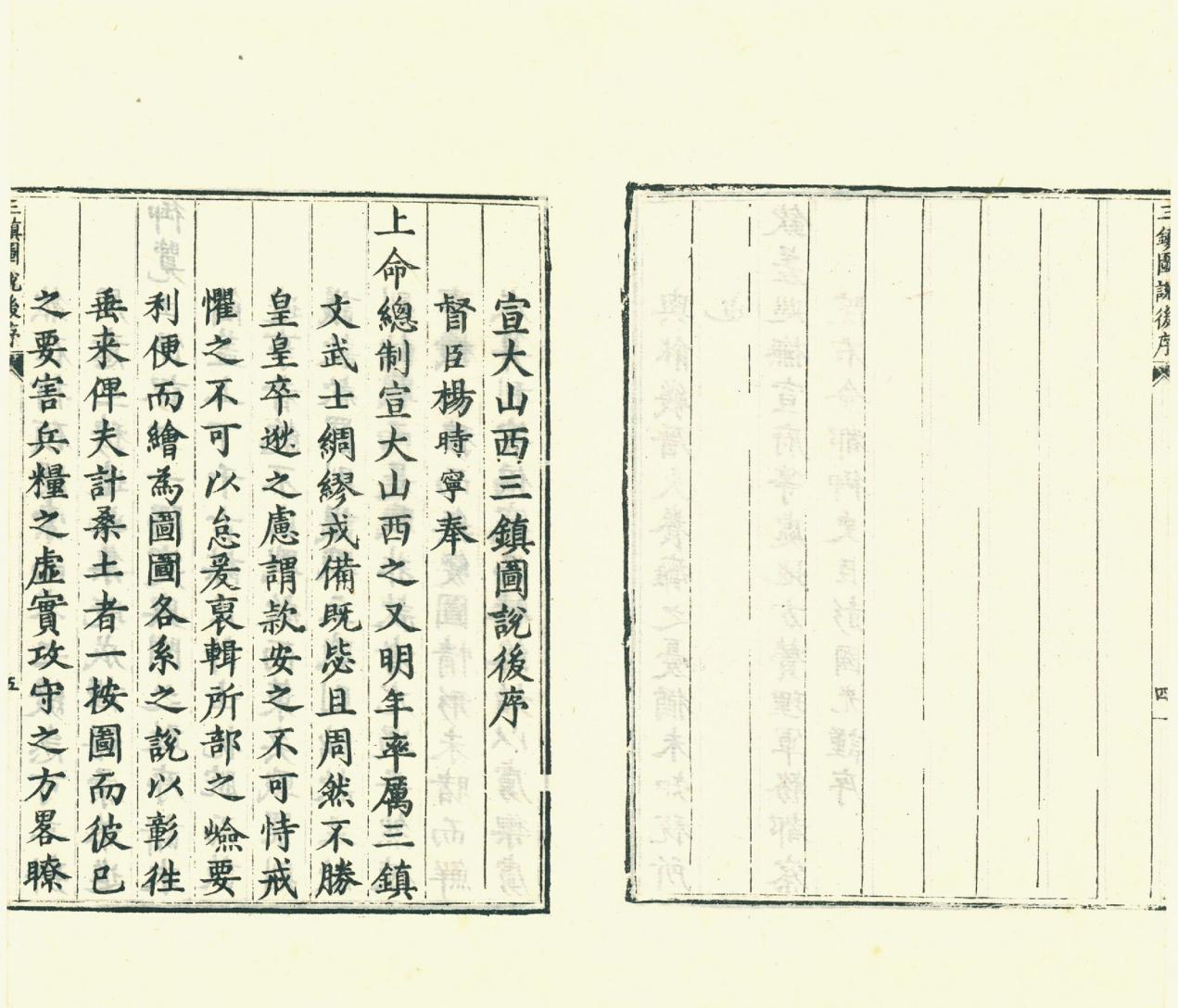
此《宣大山西三镇图说》由时任宣大山西三镇总督的杨时宁主持编修。全书共三卷,前有三镇总图,以统其纲。后分为:宣府镇、大同镇、山西镇。按镇、路、城堡逐级分别叙述,图说结合,边防形势一览在目。此内含明万历三十一年彩绘本及 1941 年景明万历时期刊本(郑振铎玄览堂丛书)。
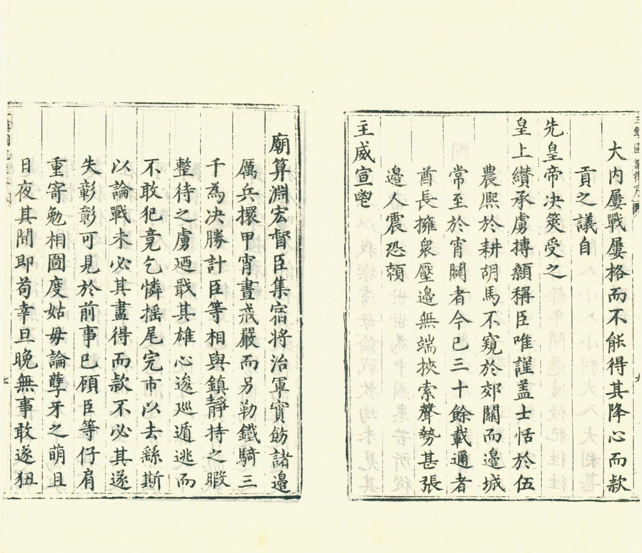
明朝中后期,国力衰微,边备松驰,“北虏南倭” 问题突出。边外的蒙古族右翼首领俺答兴起后,不时南下寇边,明、蒙边界战争不断。北边三镇宣府、大同、山西因其特殊的地理位置,决定了它们内屏京师外抗强敌的战略位置十分重要。
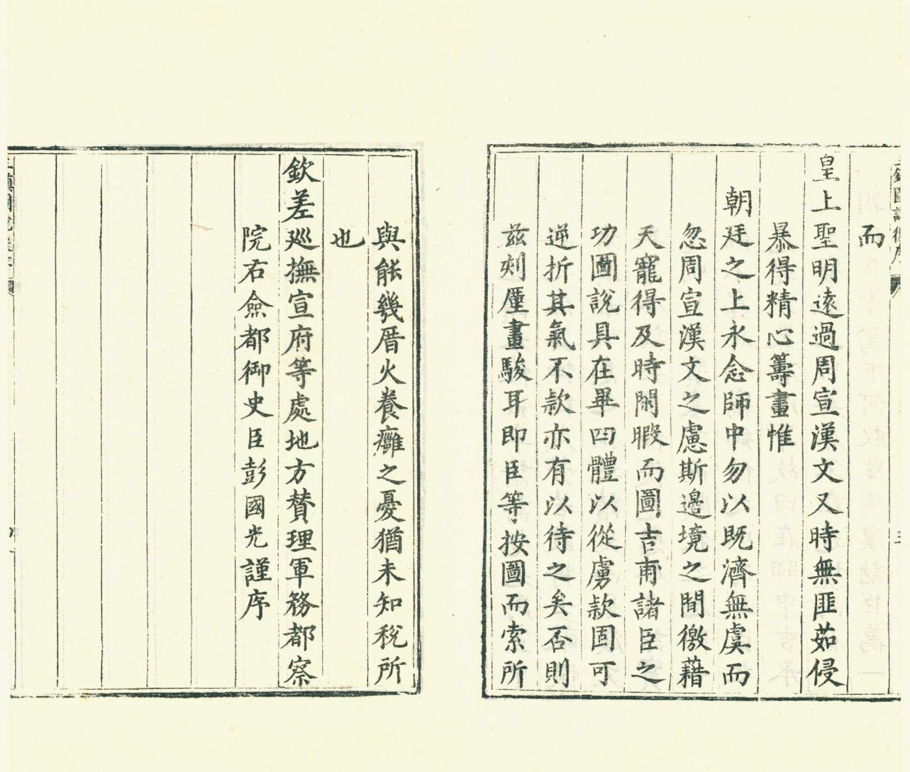
时任宣大山西三镇总督的杨时宁,一方面顺应边疆史地撰述大量涌现的潮流,另方面按朝廷的要求,于万历三十年(1602 年)组织文武将吏对宣府、大同、山西三镇进行实地调查,图画条说各镇的形胜、要害、边防情况。这项工作于万历三十一年(1603 年)十二月结束。杨时宁将此次工作的结果,编辑、整理为《宣大山西三镇图说》。该书既提出备边方略,也是北方三镇的战备地图,具有极高的实用性和实效性。
This “Illustrated Illustrations of the Three Towns of Xuanda Shanxi” was edited by Yang Shining, who was then the Governor General of the Three Towns of Xuanda Shanxi. The whole book consists of three volumes, with a general map of three towns at the beginning to unify its outline. Later divided into: Xuanfu Town, Datong Town, and Shanxi Town. Describing each town, road, and castle level by level, with a combination of illustrations and descriptions, the border defense situation is summarized in detail. This includes the painted edition of the 31st year of the Ming Wanli era and the published edition of the Jingming Wanli era in 1941 (Zheng Zhenduo Xuanlangtang Series).
In the mid to late Ming Dynasty, the national strength declined and the border defense became lax, leading to a prominent issue of “northern invasion and southern invasion”. After the rise of the Mongolian right-wing leader Anda outside the border, he occasionally went south to invade the border, and the border wars between Ming and Mongolia continued. The three northern towns of Xuanfu, Datong, and Shanxi, due to their special geographical location, have determined their strategic position as the inner screen of the capital and the outer defense against strong enemies, which is very important.
Yang Shining, who was then the Governor General of the Three Towns of Xuanda Shanxi, on the one hand followed the trend of writing a large number of border history and geography, and on the other hand, in accordance with the requirements of the court, organized civil and military officials to conduct on-site investigations of Xuanfu, Datong, and Shanxi in the thirtieth year of the Wanli reign (1602), with picture strips describing the shape, key points, and border defense situation of each town. This work was completed in December of the 31st year of the Wanli reign (1603). Yang Shining edited and organized the results of this work into “Illustrated Illustrations of the Three Towns in Shanxi Province”. This book not only proposes strategies for border preparation, but also serves as a war readiness map for the three northern towns, with high practicality and effectiveness.


Record记录 Region地理 303P 宣大山西三镇图说.三卷.明.杨时宁编.景明万历时期刊本.玄览堂丛书.1941年
历史上的今天 ( 35 ):
- 2022年-12月-16日:SEGA:Wonder Boy in Monster World 神奇小子怪物世界
- 2022年-12月-16日:SEGA:World Class Leaderboard Golf 高尔夫公开赛
- 2022年-12月-16日:SEGA:WWorld Championship Soccer II 世界足球锦标赛2
- 2022年-12月-16日:SEGA:World Cup Italia '90 世界杯
- 2022年-12月-16日:SEGA:Wolverine - Adamantium Rage 金刚狼
- 2022年-12月-16日:Kungfu武学:《醉拳·醉剑·醉棍》吴信良、李高中 (393P)
- 2022年-12月-16日:Kungfu武学:《形意拳》中国武术系列规定套路编写组 (406P)
- 2022年-12月-16日:Kungfu武学:《武当气功》刘玉增 (237P)
- 2022年-12月-16日:Kungfu武学:《拳道中枢》(又名《大成拳论》)王芗斋 (25P)
- 2022年-12月-16日:Culture文化:人民画报196311 (36P)
- 2022年-12月-16日:Culture文化:人民画报196310 (33P)
- 2022年-12月-16日:Culture文化:人民画报196309 (36P)
- 2022年-12月-16日:Culture文化:人民画报196308 (34P)
- 2022年-12月-16日:Video视频:是那个口吐细狗女
- 2022年-12月-16日:Video视频:性感美女去捕鱼
- 2022年-12月-16日:Video视频:老外神奇的胸部魔术
- 2022年-12月-16日:Video视频:现在的玩物太毁三观了
- 2022年-12月-16日:Video视频:刘强东不至于骗我们吧
- 2022年-12月-16日:Video视频:妹子特长是舌头特长
- 2022年-12月-16日:Video视频:粉红色妹子和她的车
- 2022年-12月-16日:Video视频:肤白貌美一堆美人
- 2022年-12月-16日:Video视频:吃疯狗变疯狗
- 2022年-12月-16日:Video视频:狂野的世界杯
- 2022年-12月-16日:Video视频:帅哥被花痴盯上
- 2022年-12月-16日:Video视频:孤独美女上天台了
- 2022年-12月-16日:Video视频:传说中的爆炸乳
- 2022年-12月-16日:Video视频:老婆睡得早今天
- 2022年-12月-16日:Video视频:多么高贵的性感
- 2022年-12月-16日:Video视频:美女欲脱不能
- 2022年-12月-16日:Video视频:这么多妹子喜欢哪个?
- 2022年-12月-16日:Video视频:楼上三个潘金莲
- 2022年-12月-16日:Video视频:女老板带我去商场
- 2022年-12月-16日:Video视频:美女葫芦娃抖起来
- 2022年-12月-16日:Video视频:现在妹子真不害臊
- 2022年-12月-16日:News新闻:12月16日,星期五,在这里每天60秒读懂世界! (1P)
可点 ➠ 2023年-12月-16日 ➠ 25 s ➠ ♥ 0